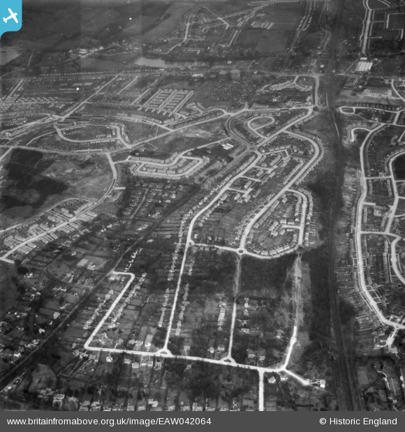
EAW042064 ENGLAND (1952). Housing estates at Poverest, Orpington, 1952
    © Hawlfraint cyfranwyr OpenStreetMap a thrwyddedwyd gan yr OpenStreetMap Foundation. 2025. Trwyddedir y gartograffeg fel CC BY-SA.
  
Delweddau cyfagos (12)
Manylion
| Pennawd | [EAW042064] Housing estates at Poverest, Orpington, 1952 | 
| Cyfeirnod | EAW042064 | 
| Dyddiad | March-1952 | 
| Dolen | |
| Enw lle | ORPINGTON | 
| Plwyf | |
| Ardal | |
| Gwlad | ENGLAND | 
| Dwyreiniad / Gogleddiad | 546035, 168636 | 
| Hydred / Lledred | 0.099461543964491, 51.397440914876 | 
| Cyfeirnod Grid Cenedlaethol | TQ460686 | 
Pinnau
|  The Bull Inn. |   garyb | Friday 1st of August 2014 04:10:44 PM | 
|  St Peters Lane. |   garyb | Friday 1st of August 2014 04:09:38 PM | 
|  Cotmandene Cresent before the shops on the St. Peters Lane side were completed. |   garyb | Friday 1st of August 2014 04:08:37 PM | 
|  Crabtrees Toy Shop, Cotmandene Cresent. The circular shaped single story building located at the end of Cotmandene.  Now an Indian resuarant. |   garyb | Friday 1st of August 2014 04:01:22 PM | 
|  Nash's Paper Mill |   garyb | Friday 1st of August 2014 03:56:53 PM | 
|  Ravenscourt Road |   garyb | Friday 1st of August 2014 03:42:38 PM | 
|  Longbury Drive. |   garyb | Friday 1st of August 2014 03:40:41 PM | 
|  Garden/Vegetable allotments located behind houses in Ravenscourt Road and Longbury Drive.  The site was developed into housing during the 1980's with a new road construction Longbury Close. |   garyb | Friday 1st of August 2014 03:39:05 PM | 
|  Leesons Hill School - The beginning of it's site preperation. |   garyb | Sunday 1st of June 2014 04:01:36 PM | 
|  A small shop (wooden I believe) called 'The Crows Nest' or 'The Nest'.  It possibly became a laundrette sometime during the early-mid 1960's. |   garyb | Sunday 1st of June 2014 03:57:42 PM | 
|  Lock-up garages rented to local residents by the LCC (London County Council) even though the area was at the time within Kent. |   garyb | Sunday 1st of June 2014 03:52:41 PM | 
|  St Barnabas CoE Church, Rushett Rd. The church with a high profile green coloured copper roof, visable from far beyond the congregation it serves. 
Replacing little more than a large tin hut acting as a place of worship located on the same site, the current day church was built during the early part of the 1960's. When virtually completed, the church was consecrated/blessed in the later part of 1964.
I would like to express my sincere thanks and appreciation to Andy Fordham, who uploaded the video to YouTube.  Should the video not play, simply go to YouTube and perform a search for 'St Barnabas St Pauls Cray' whereon the video mentioned will be at the front of the search result and playable. |   garyb | Sunday 1st of June 2014 02:37:47 PM | 
|  The Broomwood, now McDonalds |   Gone2Kent | Friday 30th of May 2014 01:36:19 PM | 
|  The Broomwood, now McDonalds |   Gone2Kent | Friday 30th of May 2014 01:36:16 PM | 
|  At the time, a privately owned orchard known to local children as 'Pop's Orchard'. |   garyb | Friday 30th of May 2014 12:06:18 AM | 
|  At the time, this was a Gypsy camp on a site known as Corke's Meadow. |   garyb | Thursday 29th of May 2014 11:41:24 PM | 
|  Now a residential site. Was a waste ground before the Crayfish Public House was built on the site sometime around the very early 1960's.  The Crayfish ceased business around 2006. |   garyb | Thursday 29th of May 2014 10:16:28 PM | 
|  St Mary Cray Train Station. |   garyb | Thursday 29th of May 2014 10:06:54 PM | 
|  Now part of the Nugent Estate. The electrical appliance manufacturer Morphy Richards previously  occupied the site from it's inception during the mid 1930's. |   garyb | Thursday 29th of May 2014 09:49:05 PM | 
Cyfraniadau Grŵp
| This image actually only shows a very small portion of the Poverest  estate. The majority of the area captured in this frame is of St Pauls Cray. |   garyb | Friday 30th of May 2014 12:31:35 AM | 
 
             
  ![[EAW042064] Housing estates at Poverest, Orpington, 1952](http://britainfromabove.org.uk/sites/all/libraries/aerofilms-images/public/100x100/EAW/042/EAW042064.jpg) 
  
                                          ![[EAW020730] New housing development around Ravensbury Road, St Paul's Cray, 1948](http://britainfromabove.org.uk/sites/all/libraries/aerofilms-images/public/100x100/EAW/020/EAW020730.jpg) 
 ![[EAW042062] Housing estates at Poverest, Orpington, 1952](http://britainfromabove.org.uk/sites/all/libraries/aerofilms-images/public/100x100/EAW/042/EAW042062.jpg) 
 ![[EAW021760] Housing estate under construction surrounding Clarendon Way and Ravensbury Road, St Paul's Cray, 1949](http://britainfromabove.org.uk/sites/all/libraries/aerofilms-images/public/100x100/EAW/021/EAW021760.jpg) 
 ![[EAW042061] Housing estates at Poverest, Orpington, 1952](http://britainfromabove.org.uk/sites/all/libraries/aerofilms-images/public/100x100/EAW/042/EAW042061.jpg) 
 ![[EAW026809] Housing estate under construction at St Paul's Cray, Bromley, 1949. This image was marked by Aerofilms Ltd for photo editing.](http://britainfromabove.org.uk/sites/all/libraries/aerofilms-images/public/100x100/EAW/026/EAW026809.jpg) 
 ![[EAW020737] Construction of housing along Ravensbury Road, St Paul's Cray, from the south, 1948](http://britainfromabove.org.uk/sites/all/libraries/aerofilms-images/public/100x100/EAW/020/EAW020737.jpg) 
 ![[EAW020739] Construction of 34-40 Ravensbury Road, St Paul's Cray, from the south, 1948](http://britainfromabove.org.uk/sites/all/libraries/aerofilms-images/public/100x100/EAW/020/EAW020739.jpg) 
 ![[EAW020736] Wimborne Avenue and construction of 1 and 3 Ravensbury Road, St Paul's Cray, from the south, 1948](http://britainfromabove.org.uk/sites/all/libraries/aerofilms-images/public/100x100/EAW/020/EAW020736.jpg) 
 ![[EAW020733] New housing development around Ravensbury Road, St Paul's Cray, 1948](http://britainfromabove.org.uk/sites/all/libraries/aerofilms-images/public/100x100/EAW/020/EAW020733.jpg) 
 ![[EAW026815] Housing estate under construction at St Paul's Cray, Bromley, 1949. This image has been produced from a print.](http://britainfromabove.org.uk/sites/all/libraries/aerofilms-images/public/100x100/EAW/026/EAW026815.jpg) 
 ![[EAW020738] Construction of 50 and 52, 75 and 77 Ravensbury Road, St Paul's Cray, 1948](http://britainfromabove.org.uk/sites/all/libraries/aerofilms-images/public/100x100/EAW/020/EAW020738.jpg)