
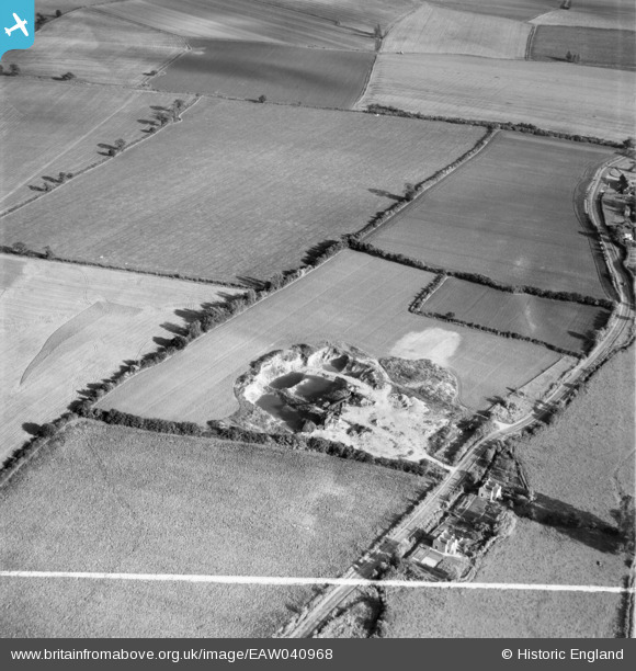
EAW040968 ENGLAND (1951). A gravel pit off the A1060, Roxwell, 1951. This image was marked by Aerofilms Ltd for photo editing.
© Hawlfraint cyfranwyr OpenStreetMap a thrwyddedwyd gan yr OpenStreetMap Foundation. 2026. Trwyddedir y gartograffeg fel CC BY-SA.
Delweddau cyfagos (8)
EAW040968

EAW040967

EAW040963

EAW040961

EAW040964

EAW040966

EAW040962

EAW040965

Manylion
| Pennawd | [EAW040968] A gravel pit off the A1060, Roxwell, 1951. This image was marked by Aerofilms Ltd for photo editing. |
| Cyfeirnod | EAW040968 |
| Dyddiad | 17-October-1951 |
| Dolen | |
| Enw lle | ROXWELL |
| Plwyf | ROXWELL |
| Ardal | |
| Gwlad | ENGLAND |
| Dwyreiniad / Gogleddiad | 565684, 208545 |
| Hydred / Lledred | 0.4005198393734, 51.750607324091 |
| Cyfeirnod Grid Cenedlaethol | TL657085 |
Pinnau
Byddwch y cyntaf i ychwanegu sylw at y ddelwedd hon!
Cyfraniadau Grŵp
Gravel pit near Roxwell |

TomRobin |
Friday 27th of June 2014 05:20:05 PM |
very pleasing to get another group of images onto the map, thanks for your help. We'll update the catalogue and post your new location data here in due course. Yours, Katy Britain from Above Cataloguing Team Leader |
Katy Whitaker |
Friday 27th of June 2014 05:20:05 PM |
EAW040961 to EAW040968 are a sequence all taken on 17/10/1951 showing the same area. |

Class31 |
Friday 6th of June 2014 07:54:40 AM |