
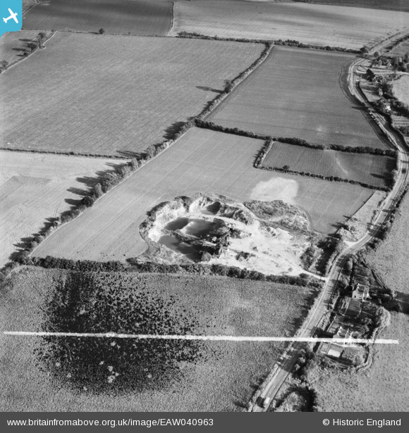
EAW040963 ENGLAND (1951). A gravel pit off the A1060, Roxwell, 1951. This image has been produced from a damaged negative.
© Hawlfraint cyfranwyr OpenStreetMap a thrwyddedwyd gan yr OpenStreetMap Foundation. 2026. Trwyddedir y gartograffeg fel CC BY-SA.
Delweddau cyfagos (8)
EAW040963

EAW040961

EAW040966

EAW040968

EAW040967

EAW040964

EAW040962

EAW040965

Manylion
| Pennawd | [EAW040963] A gravel pit off the A1060, Roxwell, 1951. This image has been produced from a damaged negative. |
| Cyfeirnod | EAW040963 |
| Dyddiad | 17-October-1951 |
| Dolen | |
| Enw lle | ROXWELL |
| Plwyf | ROXWELL |
| Ardal | |
| Gwlad | ENGLAND |
| Dwyreiniad / Gogleddiad | 565653, 208540 |
| Hydred / Lledred | 0.40006873724531, 51.75057157124 |
| Cyfeirnod Grid Cenedlaethol | TL657085 |
Pinnau
Cyfraniadau Grŵp
Gravel pit near Roxwell |

TomRobin |
Friday 27th of June 2014 05:15:07 PM |
Thanks for looking into this group TomRobin, we'll update the catalogue and post your new location data here in due course. Yours, Katy Britain from Above Cataloguing Team Leader |
Katy Whitaker |
Friday 27th of June 2014 05:15:07 PM |
EAW040961 to EAW040968 are a sequence all taken on 17/10/1951 showing the same area. |

Class31 |
Friday 6th of June 2014 07:52:06 AM |