
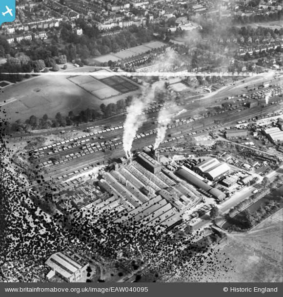
EAW040095 ENGLAND (1951). The Imperial Foundry, the station sidings and Victoria Park, Royal Leamington Spa, 1951. This image has been produced from a damaged negative.
© Hawlfraint cyfranwyr OpenStreetMap a thrwyddedwyd gan yr OpenStreetMap Foundation. 2026. Trwyddedir y gartograffeg fel CC BY-SA.
Delweddau cyfagos (19)
EAW040095

EAW000234

EAW040094

EAW000238

EAW000233

EAW000237

EPW053196

EAW000232

EAW000236

EAW040096

EPW053195

EPW053199

EPW019737

EPW053200

EAW000235

EAW000149
 Foundry off Prince's Drive, Royal Leamington Spa, 1946")
EPW053197

EPW053198

EAW000150
 Foundry off Prince's Drive, Royal Leamington Spa, 1946")
Manylion
| Pennawd | [EAW040095] The Imperial Foundry, the station sidings and Victoria Park, Royal Leamington Spa, 1951. This image has been produced from a damaged negative. |
| Cyfeirnod | EAW040095 |
| Dyddiad | 26-September-1951 |
| Dolen | |
| Enw lle | ROYAL LEAMINGTON SPA |
| Plwyf | ROYAL LEAMINGTON SPA |
| Ardal | |
| Gwlad | ENGLAND |
| Dwyreiniad / Gogleddiad | 431155, 265301 |
| Hydred / Lledred | -1.5432330070676, 52.284572978721 |
| Cyfeirnod Grid Cenedlaethol | SP312653 |


