
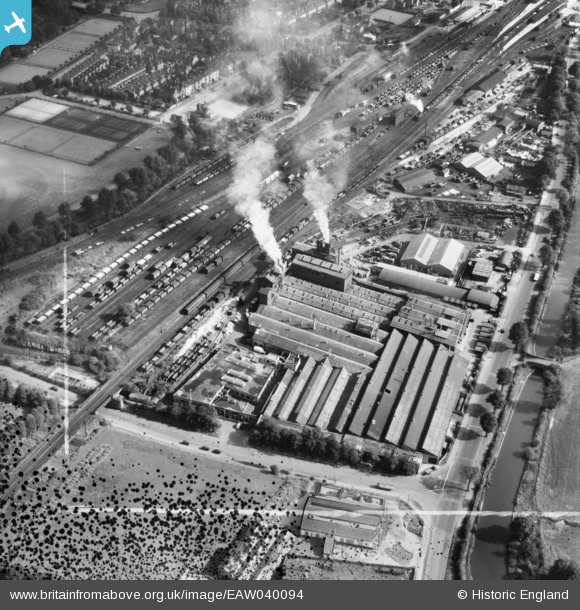
EAW040094 ENGLAND (1951). The Imperial Foundry and station sidings, Royal Leamington Spa, 1951. This image was marked by Aerofilms Ltd for photo editing.
© Hawlfraint cyfranwyr OpenStreetMap a thrwyddedwyd gan yr OpenStreetMap Foundation. 2026. Trwyddedir y gartograffeg fel CC BY-SA.
Delweddau cyfagos (19)
EAW040094

EAW000238

EAW000237

EAW000233

EPW053196

EAW000236

EPW053195

EAW040096

EAW000232

EPW053199

EAW040095

EPW053200

EAW000149
 Foundry off Prince's Drive, Royal Leamington Spa, 1946")
EPW053197

EAW000235

EAW000234

EPW053198

EAW000150
 Foundry off Prince's Drive, Royal Leamington Spa, 1946")
EPW019737

Manylion
| Pennawd | [EAW040094] The Imperial Foundry and station sidings, Royal Leamington Spa, 1951. This image was marked by Aerofilms Ltd for photo editing. |
| Cyfeirnod | EAW040094 |
| Dyddiad | 26-September-1951 |
| Dolen | |
| Enw lle | ROYAL LEAMINGTON SPA |
| Plwyf | ROYAL LEAMINGTON SPA |
| Ardal | |
| Gwlad | ENGLAND |
| Dwyreiniad / Gogleddiad | 431106, 265249 |
| Hydred / Lledred | -1.5439561770966, 52.284108221852 |
| Cyfeirnod Grid Cenedlaethol | SP311652 |
Pinnau

Philip |
Tuesday 25th of November 2014 05:56:53 AM |