
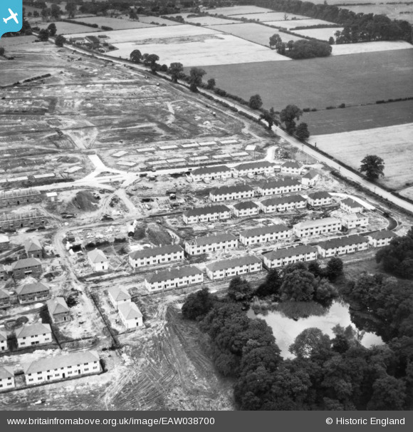
EAW038700 ENGLAND (1951). Housing construction and development around Sturgeon Avenue on the Clifton Estate, Clifton, 1951. This image has been produced from a print.
© Hawlfraint cyfranwyr OpenStreetMap a thrwyddedwyd gan yr OpenStreetMap Foundation. 2026. Trwyddedir y gartograffeg fel CC BY-SA.
Delweddau cyfagos (16)
EAW038700

EAW038705

EAW038707

EAW038699

EAW038706

EAW038703

EAW038701

EAW038698

EAW038696

EAW038704

EAW038697

EAW038702

EAW048679

EAW048687

EAW048682

EAW048680

Manylion
| Pennawd | [EAW038700] Housing construction and development around Sturgeon Avenue on the Clifton Estate, Clifton, 1951. This image has been produced from a print. |
| Cyfeirnod | EAW038700 |
| Dyddiad | 14-August-1951 |
| Dolen | |
| Enw lle | CLIFTON |
| Plwyf | |
| Ardal | |
| Gwlad | ENGLAND |
| Dwyreiniad / Gogleddiad | 455593, 335621 |
| Hydred / Lledred | -1.173157255123, 52.914813923318 |
| Cyfeirnod Grid Cenedlaethol | SK556356 |
