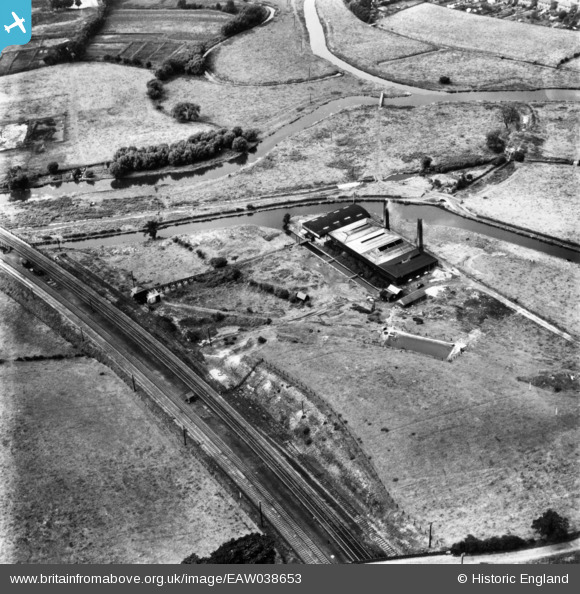
EAW038653 ENGLAND (1951). Baswich Salt Works, Baswich, 1951. This image has been produced from a print.

© Hawlfraint cyfranwyr OpenStreetMap a thrwyddedwyd gan yr OpenStreetMap Foundation. 2025. Trwyddedir y gartograffeg fel CC BY-SA.

Delweddau cyfagos (10)

EAW038653
  0° 0m
EAW038643
  312° 14m
EAW038648
  315° 24m
EAW038650
  92° 27m
EAW038649
  78° 32m
EAW038647
  267° 33m
EAW038651
  114° 36m
EAW038646
  310° 45m
EAW038652
  296° 47m
EAW038654
  330° 48m

Manylion

Pennawd [EAW038653] Baswich Salt Works, Baswich, 1951. This image has been produced from a print.
Cyfeirnod EAW038653
Dyddiad 14-August-1951
Dolen
Enw lle BASWICH
Plwyf
Ardal
Gwlad ENGLAND
Dwyreiniad / Gogleddiad 394446, 322622
Hydred / Lledred -2.0823884675121, 52.800795722922
Cyfeirnod Grid Cenedlaethol SJ944226

Pinnau

Stafford Branch Canal / River Sow Navigation. Footbridge over the River Penk. The footbridge still exists(December 2014)but no longer goes over any water following the realignment of the Rivers Penk and Sow some years ago. (Stafford Riverway Link: www.stafford-riverway-link.co.uk )(DJJ)

David
Sunday 21st of December 2014 04:49:56 PM
The Railway Bridge (Bridge 100A) over the Staffordshire and Worcestershire Canal at Baswich. (DJJ).

David
Sunday 21st of December 2014 02:51:48 PM
The River Penk, close to its confluence with the River Sow. (DJJ).

David
Sunday 21st of December 2014 02:48:53 PM
Stafford Branch Canal / River Sow Navigation. The River Sow; Tow Path, which after about 1 mile reaches the site of the former Coal Wharf by Green Bridge in the centre of Stafford. (Stafford Riverway Link: www.stafford-riverway-link.co.uk )(DJJ)

David
Sunday 21st of December 2014 01:51:23 PM
Stafford Branch Canal / River Sow Navigation. The River Sow on its way to Stafford; after about 1 mile, the river reaches the site of the former Coal Wharf by Green Bridge in the centre of Stafford. (Stafford Riverway Link: www.stafford-riverway-link.co.uk )(DJJ)

David
Sunday 21st of December 2014 01:44:34 PM
Stafford Branch Canal / River Sow Navigation. The former channel of the Navigation leading from the Stafford Branch Canal Lock (known as St Thomas' Lock or Baswich Lock)towards the River Sow. (Stafford Riverway Link: www.stafford-riverway-link.co.uk )(DJJ)

David
Sunday 21st of December 2014 01:35:51 PM
Junction of Stafford Branch Canal / River Sow Navigation with the Staffs and Worcs Canal. The former Branch Canal Basin leading to the site of the former Aqueduct which once led into the Lock. The Lock, known as St Thomas' Lock or Baswich Lock, was demolished in 1935. (Stafford Riverway Link: www.stafford-riverway-link.co.uk )(DJJ)

David
Sunday 21st of December 2014 01:30:35 PM
Junction of Stafford Branch Canal / River Sow Navigation with the Staffs and Worcs Canal. The Roving Bridge at the Junction. (Stafford Riverway Link: www.stafford-riverway-link.co.uk )(DJJ)

David
Sunday 21st of December 2014 01:24:55 PM
Junction of Stafford Branch Canal / River Sow Navigation with the Staffs and Worcs Canal. The Lock House. (Stafford Riverway Link: www.stafford-riverway-link.co.uk )(DJJ)

David
Sunday 21st of December 2014 01:23:20 PM
Junction of Stafford Branch Canal / River Sow Navigation with the Staffs and Worcs Canal. Notice the Roving Bridge at the Junction and the Lock House. (Stafford Riverway Link: www.stafford-riverway-link.co.uk )(DJJ)

David
Sunday 21st of December 2014 01:22:22 PM
The Canal Arm into the Salt Works from the Staffordshire and Worcestershire Canal. (DJJ).

David
Sunday 21st of December 2014 01:21:36 PM