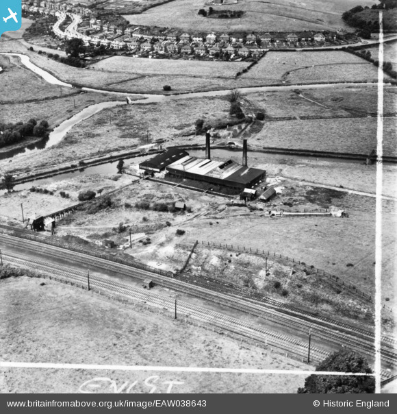
EAW038643 ENGLAND (1951). Baswich Salt Works, Baswich, 1951. This image has been produced from a print marked by Aerofilms Ltd for photo editing.

© Hawlfraint cyfranwyr OpenStreetMap a thrwyddedwyd gan yr OpenStreetMap Foundation. 2025. Trwyddedir y gartograffeg fel CC BY-SA.

Delweddau cyfagos (10)

EAW038643
  0° 0m
EAW038648
  319° 9m
EAW038653
  132° 14m
EAW038647
  241° 25m
EAW038646
  308° 30m
EAW038652
  288° 33m
EAW038654
  337° 34m
EAW038650
  106° 39m
EAW038649
  93° 43m
EAW038651
  119° 50m

Manylion

Pennawd [EAW038643] Baswich Salt Works, Baswich, 1951. This image has been produced from a print marked by Aerofilms Ltd for photo editing.
Cyfeirnod EAW038643
Dyddiad 14-August-1951
Dolen
Enw lle BASWICH
Plwyf
Ardal
Gwlad ENGLAND
Dwyreiniad / Gogleddiad 394435, 322632
Hydred / Lledred -2.082551812426, 52.800885514639
Cyfeirnod Grid Cenedlaethol SJ944226

Pinnau

My great grandfather Edwin Wall 1849 -1901 was lockkeeper here in 1881 he then became lockkeeper at Wickwick and Compton near Tettenhall, Wolverhampton in 1891

Marie Griffiths
Sunday 15th of January 2017 04:16:15 PM
Tixall Road (DJJ)

David
Monday 8th of February 2016 01:00:59 AM
Footbridge over the River Penk. (Stafford Riverway Link: www.stafford-riverway-link.co.uk )(DJJ)

David
Friday 9th of January 2015 11:14:18 PM
The River Penk, close to its confluence with the River Sow. (DJJ).

David
Sunday 21st of December 2014 02:41:23 PM
The Stafford Branch Canal / River Sow Navigation. The former channel leading from the site of the former Lock to the junction with the River Sow. The Lock (known as St Thomas' Lock or Baswich Lock) was demolished in 1935. (Stafford Riverway Link: www.stafford-riverway-link.co.uk )(DJJ)

David
Sunday 21st of December 2014 02:36:11 PM
The Stafford Branch Canal / River Sow Navigation. The Tow Path alongside the River Sow. The Tow path leads to the former Coal Wharf by Green Bridge in the centre of Stafford about 1 mile away. (Stafford Riverway Link: www.stafford-riverway-link.co.uk )(DJJ)

David
Sunday 21st of December 2014 02:32:49 PM
Stafford Branch Canal / River Sow Navigation. The River Sow; after about 1 mile, the river leads to the former Coal Wharf by Green Bridge in the centre of Stafford. (Stafford Riverway Link: www.stafford-riverway-link.co.uk )(DJJ)

David
Sunday 21st of December 2014 02:30:03 PM
Stafford Branch Canal / River Sow Navigation. The former Basin narrows and leads to the site of the former Aqueduct and Lock. The Lock (known as St Thomas' Lock or Baswich Lock) was demolished in 1935. (Stafford Riverway Link: www.stafford-riverway-link.co.uk )(DJJ)

David
Sunday 21st of December 2014 02:27:48 PM
Junction of Stafford Branch Canal / River Sow Navigation with the Staffs and Worcs Canal. The hawthorn hedge, with Lock House on left, together with Tow Path and former Basin on the right. (Stafford Riverway Link: www.stafford-riverway-link.co.uk )(DJJ)

David
Sunday 21st of December 2014 02:22:32 PM
Junction of Stafford Branch Canal / River Sow Navigation with the Staffs and Worcs Canal. The Tow Path alongside the former Basin (right), with hawthorn hedge on the left. (Stafford Riverway Link: www.stafford-riverway-link.co.uk )(DJJ)

David
Sunday 21st of December 2014 02:20:29 PM
Junction of Stafford Branch Canal / River Sow Navigation with the Staffs and Worcs Canal. Site of the former Branch Canal Basin leading from the Junction to the site of the Aqueduct. (Stafford Riverway Link: www.stafford-riverway-link.co.uk )(DJJ)

David
Sunday 21st of December 2014 02:17:57 PM
Junction of Stafford Branch Canal / River Sow Navigation with the Staffs and Worcs Canal. The Pigsty, between the Roving Bridge and the Lock House. (Stafford Riverway Link: www.stafford-riverway-link.co.uk )(DJJ)

David
Sunday 21st of December 2014 02:15:44 PM
Entrance to the Canal Arm into the Salt Works. (DJJ).

David
Sunday 21st of December 2014 02:14:06 PM
Junction of Stafford Branch Canal / River Sow Navigation with the Staffs and Worcs Canal. The Roving Bridge at the Junction. Stafford Riverway Link: www.stafford-riverway-link.co.uk )(DJJ)

David
Sunday 21st of December 2014 02:09:54 PM
Junction of Stafford Branch Canal / River Sow Navigation with the Staffs and Worcs Canal. The Lock House. The Lock House was inhabited until 1956 and was probably demolished soon after. (Stafford Riverway Link: www.stafford-riverway-link.co.uk )(DJJ)

David
Sunday 21st of December 2014 02:08:34 PM
Junction of Stafford Branch Canal / River Sow Navigation with the Staffs and Worcs Canal. Notice the Roving Bridge at the Junction and the Lock House. (Stafford Riverway Link: www.stafford-riverway-link.co.uk )(DJJ)

David
Sunday 21st of December 2014 12:24:58 PM