
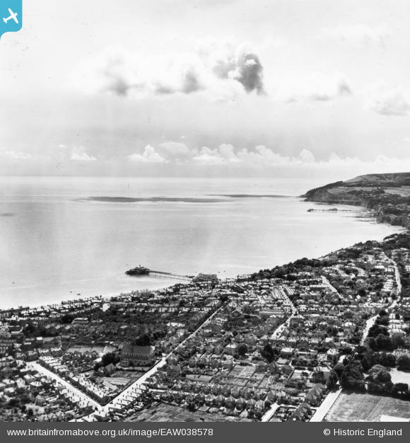
EAW038578 ENGLAND (1951). Sandown Bay and the town, Sandown, from the north, 1951. This image has been produced from a print.
© Hawlfraint cyfranwyr OpenStreetMap a thrwyddedwyd gan yr OpenStreetMap Foundation. 2026. Trwyddedir y gartograffeg fel CC BY-SA.
Delweddau cyfagos (3)
EAW038578

EPW043025

EPW016862

Manylion
| Pennawd | [EAW038578] Sandown Bay and the town, Sandown, from the north, 1951. This image has been produced from a print. |
| Cyfeirnod | EAW038578 |
| Dyddiad | 13-August-1951 |
| Dolen | |
| Enw lle | SANDOWN |
| Plwyf | SANDOWN |
| Ardal | |
| Gwlad | ENGLAND |
| Dwyreiniad / Gogleddiad | 459880, 84449 |
| Hydred / Lledred | -1.1527992992391, 50.656056151365 |
| Cyfeirnod Grid Cenedlaethol | SZ599844 |
Pinnau
Byddwch y cyntaf i ychwanegu sylw at y ddelwedd hon!