
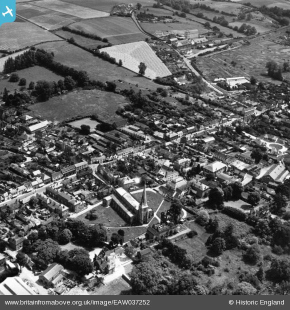
EAW037252 ENGLAND (1951). St Mary's Church and the High Street, Hadleigh, 1951. This image has been produced from a print.
© Hawlfraint cyfranwyr OpenStreetMap a thrwyddedwyd gan yr OpenStreetMap Foundation. 2025. Trwyddedir y gartograffeg fel CC BY-SA.
Delweddau cyfagos (6)
EAW037252

EAW033336

EAW033337

EAW033335

EAW037251

EAW037250

Manylion
| Pennawd | [EAW037252] St Mary's Church and the High Street, Hadleigh, 1951. This image has been produced from a print. |
| Cyfeirnod | EAW037252 |
| Dyddiad | 21-June-1951 |
| Dolen | |
| Enw lle | HADLEIGH |
| Plwyf | HADLEIGH |
| Ardal | |
| Gwlad | ENGLAND |
| Dwyreiniad / Gogleddiad | 602683, 242452 |
| Hydred / Lledred | 0.95581752303128, 52.042930559731 |
| Cyfeirnod Grid Cenedlaethol | TM027425 |
Pinnau

John W |
Wednesday 19th of August 2020 08:07:52 PM |