
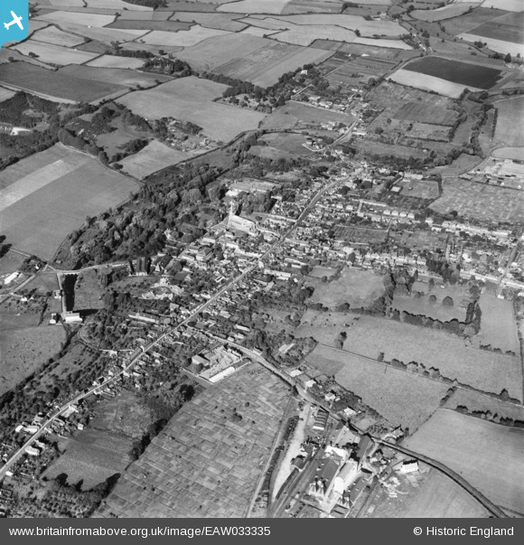
EAW033335 ENGLAND (1950). The town, Hadleigh, 1950
© Hawlfraint cyfranwyr OpenStreetMap a thrwyddedwyd gan yr OpenStreetMap Foundation. 2025. Trwyddedir y gartograffeg fel CC BY-SA.
Delweddau cyfagos (6)
EAW033335

EAW033337

EAW037252

EAW033336

EAW037251

EAW037250

Manylion
| Pennawd | [EAW033335] The town, Hadleigh, 1950 |
| Cyfeirnod | EAW033335 |
| Dyddiad | 5-October-1950 |
| Dolen | |
| Enw lle | HADLEIGH |
| Plwyf | HADLEIGH |
| Ardal | |
| Gwlad | ENGLAND |
| Dwyreiniad / Gogleddiad | 602715, 242413 |
| Hydred / Lledred | 0.95626039614326, 52.042568651859 |
| Cyfeirnod Grid Cenedlaethol | TM027424 |
Pinnau

Peter J |
Sunday 6th of December 2015 09:31:06 PM | |
|
MB |
Sunday 26th of July 2015 12:06:10 PM | |
|
MB |
Sunday 26th of July 2015 12:05:38 PM | |
|
MB |
Sunday 26th of July 2015 12:03:32 PM | |
|
MB |
Sunday 26th of July 2015 12:03:09 PM | |
|
MB |
Sunday 26th of July 2015 12:01:15 PM | |
|
MB |
Sunday 26th of July 2015 12:00:42 PM | |
|
MB |
Sunday 26th of July 2015 11:59:54 AM | |
|
MB |
Sunday 26th of July 2015 11:59:26 AM | |
|
MB |
Sunday 26th of July 2015 11:59:02 AM | |
|
MB |
Sunday 26th of July 2015 11:54:14 AM | |
|
MB |
Sunday 26th of July 2015 11:52:35 AM | |
|
MB |
Sunday 26th of July 2015 11:51:59 AM | |
|
MB |
Sunday 26th of July 2015 11:51:30 AM | |
|
Charles |
Wednesday 19th of November 2014 11:32:21 AM | |
Hadleigh station was at the end of a branch from Bentley (on the line from Colchester to Ipswich. It was an off-shoot of the Eastern Union Railway, and opened in 1847. Later became part of the Great Eastern Railway in 1862, and in the 1923 'Grouping' became part of the LNER. They closed the line to passengers in 1932! It remained open for goods into BR days, eventually closing completely in 1965. |
John W |
Wednesday 19th of August 2020 08:06:16 PM |
|
Charles |
Wednesday 19th of November 2014 11:31:36 AM |