
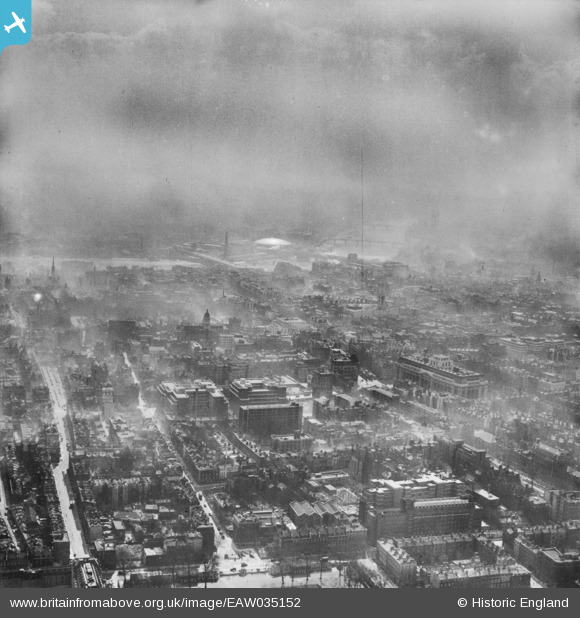
EAW035152 ENGLAND (1951). The area to the south of Coram's Fields looking towards the River Thames and Dome of Discovery, Holborn, from the north, 1951
© Hawlfraint cyfranwyr OpenStreetMap a thrwyddedwyd gan yr OpenStreetMap Foundation. 2026. Trwyddedir y gartograffeg fel CC BY-SA.
Delweddau cyfagos (7)
EAW035152

EAW011185

EAW011087

EAW000622

EAW011088

EAW011207

EAW000619

Manylion
| Pennawd | [EAW035152] The area to the south of Coram's Fields looking towards the River Thames and Dome of Discovery, Holborn, from the north, 1951 |
| Cyfeirnod | EAW035152 |
| Dyddiad | 28-March-1951 |
| Dolen | |
| Enw lle | HOLBORN |
| Plwyf | |
| Ardal | |
| Gwlad | ENGLAND |
| Dwyreiniad / Gogleddiad | 530579, 181873 |
| Hydred / Lledred | -0.11771547044356, 51.520180373601 |
| Cyfeirnod Grid Cenedlaethol | TQ306819 |
Pinnau

Nowy Paul |
Saturday 3rd of August 2019 02:28:14 PM | |

Class31 |
Wednesday 2nd of September 2015 05:04:57 PM | |
|
Class31 |
Saturday 14th of June 2014 07:17:47 PM | |
|
Class31 |
Saturday 14th of June 2014 07:17:19 PM | |
|
Class31 |
Saturday 14th of June 2014 07:16:51 PM |
