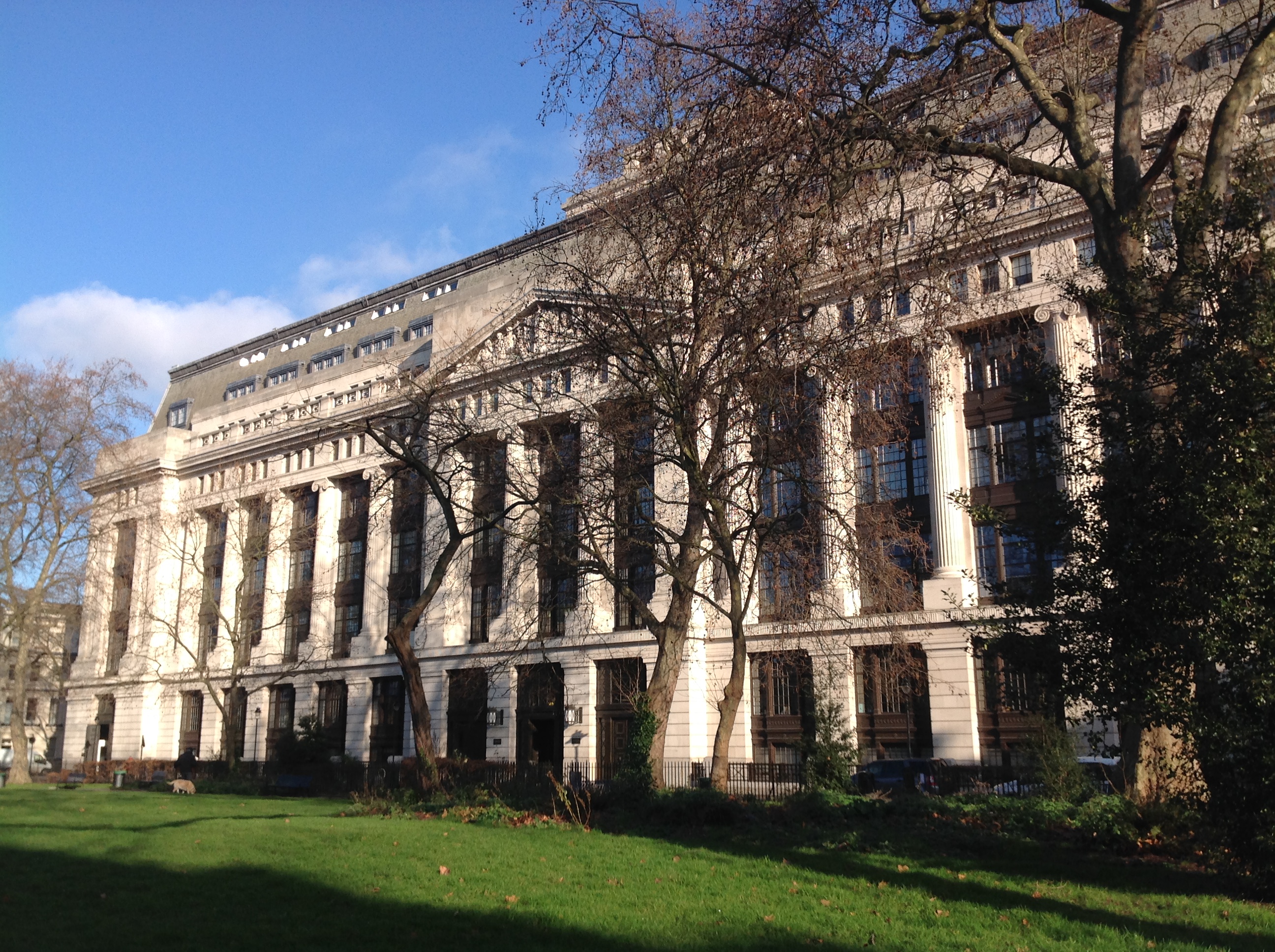
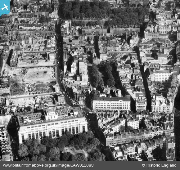
EAW011088 ENGLAND (1947). Red Lion Square, Victoria House and environs, Holborn, 1947
    © Hawlfraint cyfranwyr OpenStreetMap a thrwyddedwyd gan yr OpenStreetMap Foundation. 2025. Trwyddedir y gartograffeg fel CC BY-SA.
  
Delweddau cyfagos (10)
Manylion
| Pennawd | [EAW011088] Red Lion Square, Victoria House and environs, Holborn, 1947 | 
| Cyfeirnod | EAW011088 | 
| Dyddiad | 30-October-1947 | 
| Dolen | |
| Enw lle | HOLBORN | 
| Plwyf | |
| Ardal | |
| Gwlad | ENGLAND | 
| Dwyreiniad / Gogleddiad | 530583, 181708 | 
| Hydred / Lledred | -0.11771899812497, 51.518696491395 | 
| Cyfeirnod Grid Cenedlaethol | TQ306817 | 
Pinnau
|  This end of Lambs Conduit Passage was bombed late 1943. |   Mark B | Monday 11th of April 2022 03:18:53 PM | 
|  Dolphin Inn. Lambs Conduit Passage. |   Mark B | Monday 11th of April 2022 03:17:55 PM | 
|  Trolleybus turning into Panton Street the  Holborn Trolleybus terminus. |   brianbeckett | Friday 9th of February 2018 04:54:34 PM | 
|  future site of Mercury House, HQ of Cable & Wireless |   brianbeckett | Friday 9th of February 2018 04:51:47 PM | 
| Class31 | Tuesday 20th of January 2015 02:20:22 PM | |
| Class31 | Tuesday 20th of January 2015 02:19:22 PM | |
| Class31 | Tuesday 20th of January 2015 02:18:31 PM | |
| Class31 | Tuesday 20th of January 2015 02:16:26 PM | |
| Class31 | Tuesday 20th of January 2015 02:14:36 PM | |
|  Red Lion Street |   millsi | Monday 28th of July 2014 11:42:38 AM | 
|  High Holborn | Class31 | Monday 12th of May 2014 11:35:13 AM | 
|  Southampton Row | Class31 | Monday 12th of May 2014 11:34:21 AM | 
|  Theobald's Road | Class31 | Monday 12th of May 2014 11:32:07 AM | 
|   Alan McFaden | Sunday 10th of November 2013 04:29:56 PM | |
|   Alan McFaden | Sunday 10th of November 2013 04:29:22 PM | 
 
             
  ![[EAW011088] Red Lion Square, Victoria House and environs, Holborn, 1947](http://britainfromabove.org.uk/sites/all/libraries/aerofilms-images/public/100x100/EAW/011/EAW011088.jpg) 
  
                                          ![[EPW025609] Kingsway and environs, Holborn, 1928](http://britainfromabove.org.uk/sites/all/libraries/aerofilms-images/public/100x100/EPW/025/EPW025609.jpg) 
 ![[EAW011185] Construction work around New North Street and environs, Holborn, 1947](http://britainfromabove.org.uk/sites/all/libraries/aerofilms-images/public/100x100/EAW/011/EAW011185.jpg) 
 ![[EAW035152] The area to the south of Coram's Fields looking towards the River Thames and Dome of Discovery, Holborn, from the north, 1951](http://britainfromabove.org.uk/sites/all/libraries/aerofilms-images/public/100x100/EAW/035/EAW035152.jpg) 
 ![[EAW000622] A cityscape over Bloomsbury including Victoria House, Bloomsbury, from the south, 1946](http://britainfromabove.org.uk/sites/all/libraries/aerofilms-images/public/100x100/EAW/000/EAW000622.jpg) 
 ![[EAW000619] Lincoln's Inn Fields and Gray's Inn Gardens, Holborn, 1946](http://britainfromabove.org.uk/sites/all/libraries/aerofilms-images/public/100x100/EAW/000/EAW000619.jpg) 
 ![[EAW043628] Holborn, High Holborn and the surrounding city, Holborn, 1952](http://britainfromabove.org.uk/sites/all/libraries/aerofilms-images/public/100x100/EAW/043/EAW043628.jpg) 
 ![[EPW045611] The River Thames and the city from Tower Bridge to Waterloo Bridge with the British Museum in the foreground, Bloomsbury, from the north-west, 1934](http://britainfromabove.org.uk/sites/all/libraries/aerofilms-images/public/100x100/EPW/045/EPW045611.jpg) 
 ![[EAW011089] High Holborn and Lincoln's Inn Fields, Holborn, 1947](http://britainfromabove.org.uk/sites/all/libraries/aerofilms-images/public/100x100/EAW/011/EAW011089.jpg) 
 ![[EPW021403] Lincoln's Inn Fields and the River Thames, Holborn, from the north-west, 1928](http://britainfromabove.org.uk/sites/all/libraries/aerofilms-images/public/100x100/EPW/021/EPW021403.jpg) 
 
