
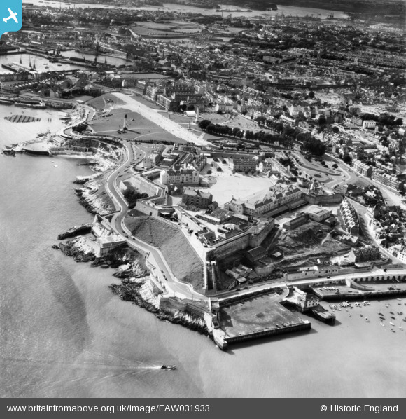
EAW031933 ENGLAND (1950). The Hoe and the Royal Citadel, Plymouth, 1950
© Hawlfraint cyfranwyr OpenStreetMap a thrwyddedwyd gan yr OpenStreetMap Foundation. 2026. Trwyddedir y gartograffeg fel CC BY-SA.
Delweddau cyfagos (3)
EAW031933

EAW006008

EAW031932

Manylion
| Pennawd | [EAW031933] The Hoe and the Royal Citadel, Plymouth, 1950 |
| Cyfeirnod | EAW031933 |
| Dyddiad | 17-August-1950 |
| Dolen | |
| Enw lle | PLYMOUTH |
| Plwyf | |
| Ardal | |
| Gwlad | ENGLAND |
| Dwyreiniad / Gogleddiad | 248126, 53768 |
| Hydred / Lledred | -4.1356027706012, 50.363580853701 |
| Cyfeirnod Grid Cenedlaethol | SX481538 |
Pinnau

redmist |
Tuesday 15th of December 2020 02:23:39 PM | |
|
redmist |
Tuesday 15th of December 2020 01:39:16 PM | |
|
Rhistel Liadon |
Sunday 24th of August 2014 02:39:52 PM | |
|
Coventry kid |
Sunday 27th of April 2014 04:51:05 PM |