
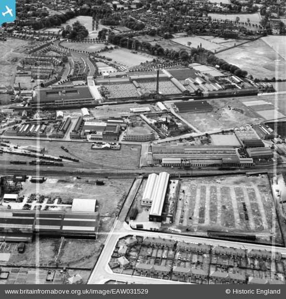
EAW031529 ENGLAND (1950). The H. W. Kearns and Co Ltd Engineering Works and the Linotype Works, Broadheath, 1950. This image was marked by Aerofilms Ltd for photo editing.
© Hawlfraint cyfranwyr OpenStreetMap a thrwyddedwyd gan yr OpenStreetMap Foundation. 2026. Trwyddedir y gartograffeg fel CC BY-SA.
Delweddau cyfagos (13)
EAW031529

EAW031527

EAW031525

EAW031524

EAW031521

EAW031522

EAW031526

EAW031528

EAW031523

EPW050673

EPW038468

EPW038470

EPW016489

Manylion
| Pennawd | [EAW031529] The H. W. Kearns and Co Ltd Engineering Works and the Linotype Works, Broadheath, 1950. This image was marked by Aerofilms Ltd for photo editing. |
| Cyfeirnod | EAW031529 |
| Dyddiad | 26-July-1950 |
| Dolen | |
| Enw lle | BROADHEATH |
| Plwyf | |
| Ardal | |
| Gwlad | ENGLAND |
| Dwyreiniad / Gogleddiad | 376183, 389115 |
| Hydred / Lledred | -2.3582312965015, 53.398063484509 |
| Cyfeirnod Grid Cenedlaethol | SJ762891 |
Pinnau

Matt Aldred edob.mattaldred.com |
Wednesday 17th of August 2022 03:25:33 PM | |
|
Matt Aldred edob.mattaldred.com |
Wednesday 17th of August 2022 03:14:58 PM | |

AltyCivicSoc |
Monday 13th of July 2020 05:11:12 PM |
