
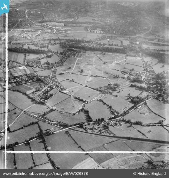
EAW026878 ENGLAND (1949). Henbury Housing Estate under construction, Henbury, 1949. This image was marked by Aerofilms Ltd for photo editing.
© Hawlfraint cyfranwyr OpenStreetMap a thrwyddedwyd gan yr OpenStreetMap Foundation. 2026. Trwyddedir y gartograffeg fel CC BY-SA.
Delweddau cyfagos (6)
EAW026878

EAW026879

EAW026880

EAW026870

EAW026875

EAW026873
, Henbury, 1949. This image has been produced from a damaged negative.")
Manylion
| Pennawd | [EAW026878] Henbury Housing Estate under construction, Henbury, 1949. This image was marked by Aerofilms Ltd for photo editing. |
| Cyfeirnod | EAW026878 |
| Dyddiad | 2-October-1949 |
| Dolen | |
| Enw lle | HENBURY |
| Plwyf | |
| Ardal | |
| Gwlad | ENGLAND |
| Dwyreiniad / Gogleddiad | 356834, 179179 |
| Hydred / Lledred | -2.6220648202487, 51.50940681017 |
| Cyfeirnod Grid Cenedlaethol | ST568792 |
Pinnau

Buzzard |
Tuesday 27th of October 2015 09:35:24 AM | |
|
Buzzard |
Tuesday 27th of October 2015 09:33:20 AM | |
|
Buzzard |
Tuesday 27th of October 2015 09:32:42 AM | |
|
Buzzard |
Tuesday 27th of October 2015 09:31:38 AM | |
|
Buzzard |
Tuesday 27th of October 2015 09:30:56 AM | |
|
Buzzard |
Tuesday 27th of October 2015 09:28:35 AM | |
|
Geoff |
Wednesday 16th of September 2015 05:56:16 PM | |
|
Geoff |
Wednesday 16th of September 2015 05:52:53 PM | |
|
Geoff |
Wednesday 16th of September 2015 05:51:38 PM | |
|
Buzzard |
Tuesday 19th of May 2015 11:56:18 PM | |
|
Buzzard |
Monday 6th of October 2014 06:42:35 PM | |
|
Buzzard |
Monday 6th of October 2014 06:41:36 PM | |
|
Buzzard |
Monday 6th of October 2014 06:40:52 PM | |
|
Buzzard |
Monday 6th of October 2014 06:40:09 PM |