
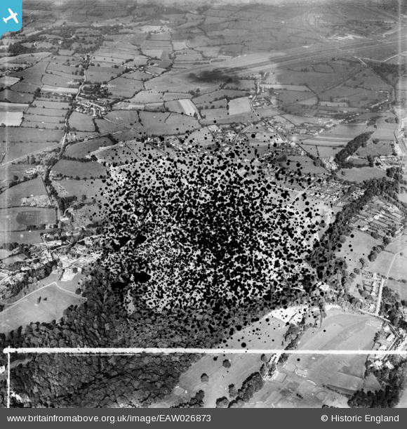
EAW026873 ENGLAND (1949). Henbury Housing Estate under construction (site of), Henbury, 1949. This image has been produced from a damaged negative.
© Hawlfraint cyfranwyr OpenStreetMap a thrwyddedwyd gan yr OpenStreetMap Foundation. 2026. Trwyddedir y gartograffeg fel CC BY-SA.
Delweddau cyfagos (10)
EAW026873
, Henbury, 1949. This image has been produced from a damaged negative.")
EAW026877

EAW026872

EAW026875

EAW026880

EAW026876

EAW026879

EAW026871

EAW026874

EAW026878

Manylion
| Pennawd | [EAW026873] Henbury Housing Estate under construction (site of), Henbury, 1949. This image has been produced from a damaged negative. |
| Cyfeirnod | EAW026873 |
| Dyddiad | 2-October-1949 |
| Dolen | |
| Enw lle | HENBURY |
| Plwyf | |
| Ardal | |
| Gwlad | ENGLAND |
| Dwyreiniad / Gogleddiad | 356973, 178945 |
| Hydred / Lledred | -2.6200332570804, 51.507313294623 |
| Cyfeirnod Grid Cenedlaethol | ST570789 |
Pinnau

Buzzard |
Tuesday 27th of October 2015 10:53:51 AM | |
|
Buzzard |
Tuesday 27th of October 2015 10:52:24 AM | |
|
Buzzard |
Tuesday 27th of October 2015 10:51:40 AM | |
|
Buzzard |
Tuesday 27th of October 2015 10:50:33 AM | |
|
Buzzard |
Tuesday 27th of October 2015 10:49:47 AM | |
|
Buzzard |
Tuesday 27th of October 2015 10:49:07 AM | |

Class31 |
Monday 9th of June 2014 10:26:56 AM | |
|
Class31 |
Monday 9th of June 2014 10:15:14 AM |

