
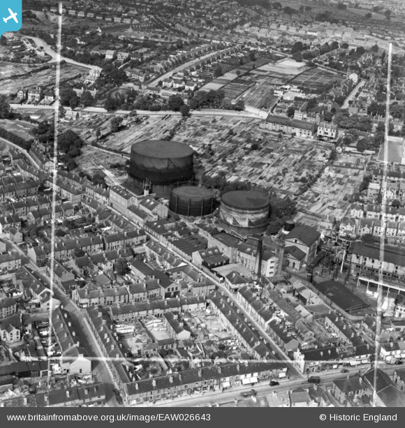
EAW026643 ENGLAND (1949). The Chester Street Gas Works and environs, Chesterfield, 1949. This image has been produced from a print marked by Aerofilms Ltd for photo editing.
© Hawlfraint cyfranwyr OpenStreetMap a thrwyddedwyd gan yr OpenStreetMap Foundation. 2026. Trwyddedir y gartograffeg fel CC BY-SA.
Delweddau cyfagos (3)
EAW026643

EAW026642

EAW026640

Manylion
| Pennawd | [EAW026643] The Chester Street Gas Works and environs, Chesterfield, 1949. This image has been produced from a print marked by Aerofilms Ltd for photo editing. |
| Cyfeirnod | EAW026643 |
| Dyddiad | 19-September-1949 |
| Dolen | |
| Enw lle | CHESTERFIELD |
| Plwyf | |
| Ardal | |
| Gwlad | ENGLAND |
| Dwyreiniad / Gogleddiad | 437421, 371256 |
| Hydred / Lledred | -1.4392680540053, 53.236734351553 |
| Cyfeirnod Grid Cenedlaethol | SK374713 |
Pinnau

dd1000 |
Friday 19th of July 2019 03:17:33 PM |