
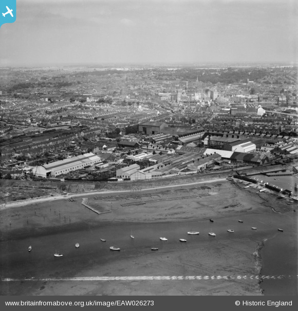
EAW026273 ENGLAND (1949). The Eagle Works, Waterside Works and the town, Ipswich, from the south, 1949. This image was marked by Aerofilms Ltd for photo editing.
© Hawlfraint cyfranwyr OpenStreetMap a thrwyddedwyd gan yr OpenStreetMap Foundation. 2026. Trwyddedir y gartograffeg fel CC BY-SA.
Delweddau cyfagos (21)
EAW026273

EAW026268

EAW026266

EAW025110

EAW026271

EAW026272

EAW026269

EAW026265

EAW025114

EAW025115

EAW026267

EAW026270

EAW025111

EAW025112

EAW025113

EPW032851

EAW025109

EPW041401

EAW024669

EAW024670

EAW025108

Manylion
| Pennawd | [EAW026273] The Eagle Works, Waterside Works and the town, Ipswich, from the south, 1949. This image was marked by Aerofilms Ltd for photo editing. |
| Cyfeirnod | EAW026273 |
| Dyddiad | 19-August-1949 |
| Dolen | |
| Enw lle | IPSWICH |
| Plwyf | |
| Ardal | |
| Gwlad | ENGLAND |
| Dwyreiniad / Gogleddiad | 616567, 242997 |
| Hydred / Lledred | 1.1583173487721, 52.042574546202 |
| Cyfeirnod Grid Cenedlaethol | TM166430 |
Pinnau
Byddwch y cyntaf i ychwanegu sylw at y ddelwedd hon!