
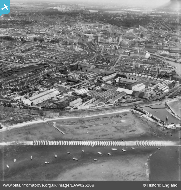
EAW026268 ENGLAND (1949). The Eagle Works, the Waterside Works and environs, Ipswich, from the south, 1949. This image has been produced from a print marked by Aerofilms Ltd for photo editing.
© Hawlfraint cyfranwyr OpenStreetMap a thrwyddedwyd gan yr OpenStreetMap Foundation. 2026. Trwyddedir y gartograffeg fel CC BY-SA.
Delweddau cyfagos (22)
EAW026268

EAW026273

EAW026266

EAW025110

EAW026271

EAW026272

EAW026269

EAW025115

EAW026265

EAW025114

EAW026267

EAW026270

EAW025111

EAW025112

EPW032851

EAW025113

EPW041401

EAW025109

EAW024669

EAW024670

EAW025108

EPW043661

Manylion
| Pennawd | [EAW026268] The Eagle Works, the Waterside Works and environs, Ipswich, from the south, 1949. This image has been produced from a print marked by Aerofilms Ltd for photo editing. |
| Cyfeirnod | EAW026268 |
| Dyddiad | 19-August-1949 |
| Dolen | |
| Enw lle | IPSWICH |
| Plwyf | |
| Ardal | |
| Gwlad | ENGLAND |
| Dwyreiniad / Gogleddiad | 616584, 242977 |
| Hydred / Lledred | 1.1585521920369, 52.042388345589 |
| Cyfeirnod Grid Cenedlaethol | TM166430 |
Pinnau

Sparky |
Thursday 7th of September 2017 10:44:51 PM |