
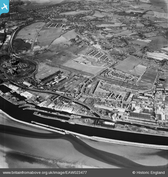
EAW023477 ENGLAND (1949). The New and Old Basins on the Manchester Ship Canal, Sandy Lane and environs, Weston Point, 1949
© Hawlfraint cyfranwyr OpenStreetMap a thrwyddedwyd gan yr OpenStreetMap Foundation. 2026. Trwyddedir y gartograffeg fel CC BY-SA.
Delweddau cyfagos (2)
EAW023477

EAW021993

Manylion
| Pennawd | [EAW023477] The New and Old Basins on the Manchester Ship Canal, Sandy Lane and environs, Weston Point, 1949 |
| Cyfeirnod | EAW023477 |
| Dyddiad | 26-May-1949 |
| Dolen | |
| Enw lle | WESTON POINT |
| Plwyf | |
| Ardal | |
| Gwlad | ENGLAND |
| Dwyreiniad / Gogleddiad | 349850, 381396 |
| Hydred / Lledred | -2.7530536060122, 53.326833259391 |
| Cyfeirnod Grid Cenedlaethol | SJ499814 |
Pinnau

Bottom Yard |
Sunday 30th of March 2025 02:44:02 PM | |
|
Bottom Yard |
Sunday 30th of March 2025 02:42:15 PM |