
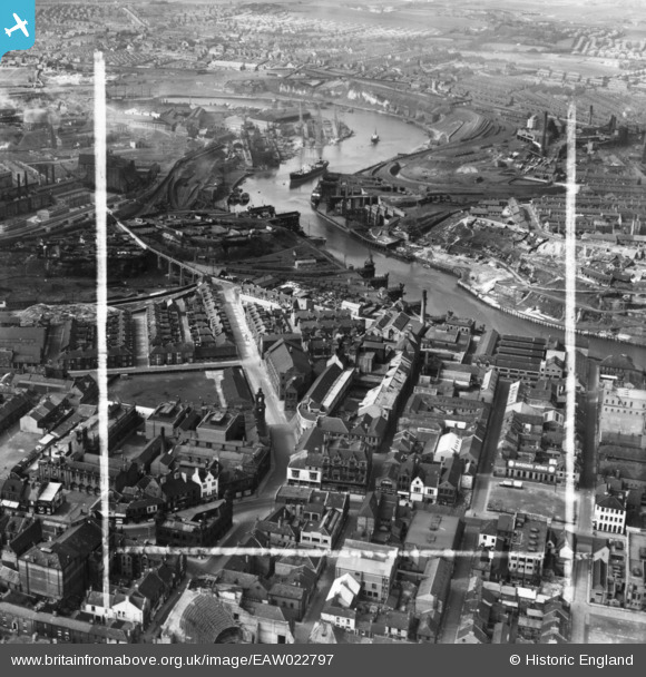
EAW022797 ENGLAND (1949). The Vaux and Associated Breweries Ltd Brewery on Castle Street and environs, Sunderland, 1949. This image has been produced from a print marked by Aerofilms Ltd for photo editing.
© Hawlfraint cyfranwyr OpenStreetMap a thrwyddedwyd gan yr OpenStreetMap Foundation. 2026. Trwyddedir y gartograffeg fel CC BY-SA.
Delweddau cyfagos (16)
EAW022797

EAW022831

EAW022794

EAW022793

EAW022795

EAW022796

EAW022830

EAW022798

EPW020542

EPW020544

EPW020540

EPW010360

EAW001028

EPW020545

EPW051127

EPW020543

Manylion
| Pennawd | [EAW022797] The Vaux and Associated Breweries Ltd Brewery on Castle Street and environs, Sunderland, 1949. This image has been produced from a print marked by Aerofilms Ltd for photo editing. |
| Cyfeirnod | EAW022797 |
| Dyddiad | 1-May-1949 |
| Dolen | |
| Enw lle | SUNDERLAND |
| Plwyf | |
| Ardal | |
| Gwlad | ENGLAND |
| Dwyreiniad / Gogleddiad | 439339, 557277 |
| Hydred / Lledred | -1.3863568642213, 54.908572435441 |
| Cyfeirnod Grid Cenedlaethol | NZ393573 |
Pinnau

redmist |
Saturday 26th of September 2020 05:07:12 PM | |
|
redmist |
Saturday 26th of September 2020 05:05:01 PM | |
|
redmist |
Saturday 26th of September 2020 05:04:14 PM |