
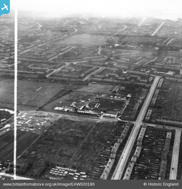
EAW020186 ENGLAND (1948). The W. J. Barton Ltd Bakery on Kemp Road and environs, Dagenham, from the north, 1948. This image has been produced from a print marked by Aerofilms Ltd for photo editing.
© Hawlfraint cyfranwyr OpenStreetMap a thrwyddedwyd gan yr OpenStreetMap Foundation. 2026. Trwyddedir y gartograffeg fel CC BY-SA.
Delweddau cyfagos (13)
EAW020186

EAW020196

EPW006555

EAW020195

EAW020191

EAW020193

EAW020190

EAW020192

EAW020189

EAW020188

EAW020185

EAW020187

EAW020194

Manylion
| Pennawd | [EAW020186] The W. J. Barton Ltd Bakery on Kemp Road and environs, Dagenham, from the north, 1948. This image has been produced from a print marked by Aerofilms Ltd for photo editing. |
| Cyfeirnod | EAW020186 |
| Dyddiad | 28-October-1948 |
| Dolen | |
| Enw lle | DAGENHAM |
| Plwyf | |
| Ardal | |
| Gwlad | ENGLAND |
| Dwyreiniad / Gogleddiad | 547928, 187306 |
| Hydred / Lledred | 0.13447718517842, 51.56472487666 |
| Cyfeirnod Grid Cenedlaethol | TQ479873 |
