
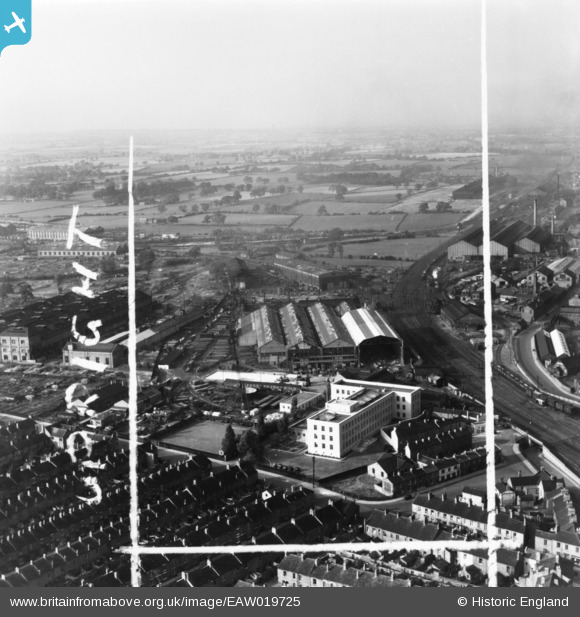
EAW019725 ENGLAND (1948). The Whessoe Engineering Works and environs, Darlington, from the south-east, 1948. This image has been produced from a print marked by Aerofilms Ltd for photo editing.
© Hawlfraint cyfranwyr OpenStreetMap a thrwyddedwyd gan yr OpenStreetMap Foundation. 2026. Trwyddedir y gartograffeg fel CC BY-SA.
Delweddau cyfagos (20)
EAW019725

EAW019724

EAW019719

EPW062174

EPW062179

EPW031544

EPW062180

EPW062183

EPW062173

EAW019726

EAW019728

EAW019727

EPW062182

EAW019726A

EPW029509

EPW031540

EPW031541

EPW031539

EPW031543

EPW031542

Manylion
| Pennawd | [EAW019725] The Whessoe Engineering Works and environs, Darlington, from the south-east, 1948. This image has been produced from a print marked by Aerofilms Ltd for photo editing. |
| Cyfeirnod | EAW019725 |
| Dyddiad | 6-October-1948 |
| Dolen | |
| Enw lle | DARLINGTON |
| Plwyf | |
| Ardal | |
| Gwlad | ENGLAND |
| Dwyreiniad / Gogleddiad | 428626, 515883 |
| Hydred / Lledred | -1.5575314132234, 54.537278547581 |
| Cyfeirnod Grid Cenedlaethol | NZ286159 |
