
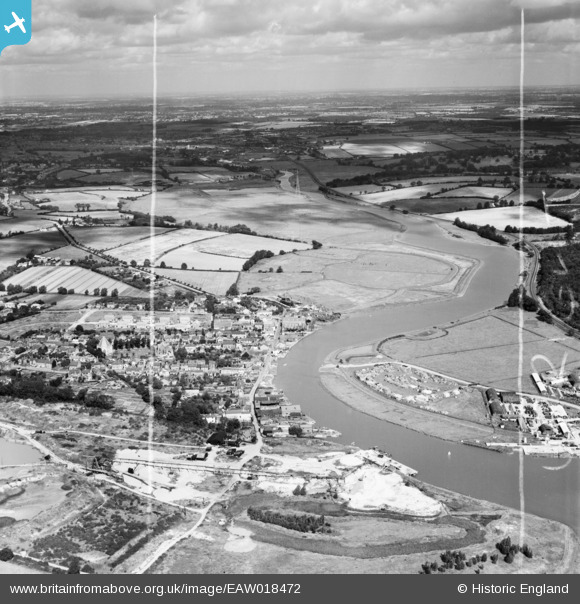
EAW018472 ENGLAND (1948). The Rowhedge Ironworks Co Shipbuilding Yard, the village and the surrounding countryside, Rowhedge, from the south-east, 1948. This image was marked by Aerofilms Ltd for photo editing.
© Hawlfraint cyfranwyr OpenStreetMap a thrwyddedwyd gan yr OpenStreetMap Foundation. 2026. Trwyddedir y gartograffeg fel CC BY-SA.
Delweddau cyfagos (7)
EAW018472

EAW018473

EAW018474

EAW018470

EAW018471

EAW018469

EAW018468

Manylion
| Pennawd | [EAW018472] The Rowhedge Ironworks Co Shipbuilding Yard, the village and the surrounding countryside, Rowhedge, from the south-east, 1948. This image was marked by Aerofilms Ltd for photo editing. |
| Cyfeirnod | EAW018472 |
| Dyddiad | 1-September-1948 |
| Dolen | |
| Enw lle | ROWHEDGE |
| Plwyf | EAST DONYLAND |
| Ardal | |
| Gwlad | ENGLAND |
| Dwyreiniad / Gogleddiad | 603276, 221456 |
| Hydred / Lledred | 0.95203700266579, 51.854173036425 |
| Cyfeirnod Grid Cenedlaethol | TM033215 |
Pinnau

Matt Aldred edob.mattaldred.com |
Tuesday 3rd of September 2019 08:55:14 AM | |
|
Matt Aldred edob.mattaldred.com |
Tuesday 3rd of September 2019 08:54:53 AM |