
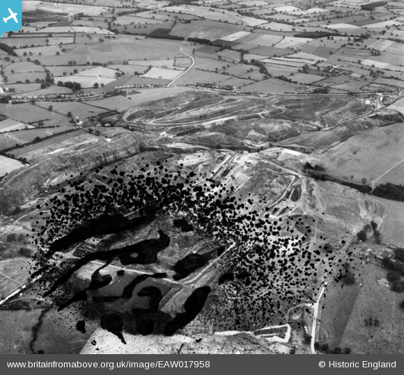
EAW017958 ENGLAND (1948). Opencast coal mining to the north of Carrington's Farm, Denby Village, 1948. This image has been produced from a damaged negative.
© Hawlfraint cyfranwyr OpenStreetMap a thrwyddedwyd gan yr OpenStreetMap Foundation. 2026. Trwyddedir y gartograffeg fel CC BY-SA.
Delweddau cyfagos (8)
EAW017958

EAW011252

EAW011226

EAW011228

EAW011233

EAW011238

EAW018400

EAW025916

Manylion
| Pennawd | [EAW017958] Opencast coal mining to the north of Carrington's Farm, Denby Village, 1948. This image has been produced from a damaged negative. |
| Cyfeirnod | EAW017958 |
| Dyddiad | 10-August-1948 |
| Dolen | |
| Enw lle | DENBY VILLAGE |
| Plwyf | DENBY |
| Ardal | |
| Gwlad | ENGLAND |
| Dwyreiniad / Gogleddiad | 441078, 345899 |
| Hydred / Lledred | -1.387721206304, 53.008516863946 |
| Cyfeirnod Grid Cenedlaethol | SK411459 |
Pinnau

Matt Aldred edob.mattaldred.com |
Friday 13th of October 2023 02:22:08 PM | |

Class31 |
Sunday 21st of December 2014 04:49:23 PM |
