
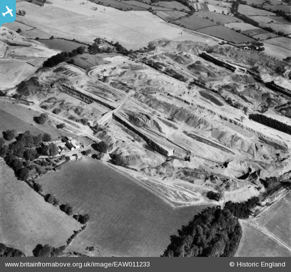
EAW011233 ENGLAND (1947). Opencast coal mining to the east of Flamstead Farm, Denby Village, 1947
© Hawlfraint cyfranwyr OpenStreetMap a thrwyddedwyd gan yr OpenStreetMap Foundation. 2026. Trwyddedir y gartograffeg fel CC BY-SA.
Delweddau cyfagos (3)
EAW011233

EAW011231

EAW017958

Manylion
| Pennawd | [EAW011233] Opencast coal mining to the east of Flamstead Farm, Denby Village, 1947 |
| Cyfeirnod | EAW011233 |
| Dyddiad | 30-September-1947 |
| Dolen | |
| Enw lle | DENBY VILLAGE |
| Plwyf | DENBY |
| Ardal | |
| Gwlad | ENGLAND |
| Dwyreiniad / Gogleddiad | 440840, 346023 |
| Hydred / Lledred | -1.391252757494, 53.009649795915 |
| Cyfeirnod Grid Cenedlaethol | SK408460 |
Pinnau
Byddwch y cyntaf i ychwanegu sylw at y ddelwedd hon!