
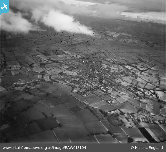
EAW013104 ENGLAND (1948). The village and surrounding countryside, Street, 1948. This image has been produced from a damaged negative.
© Hawlfraint cyfranwyr OpenStreetMap a thrwyddedwyd gan yr OpenStreetMap Foundation. 2026. Trwyddedir y gartograffeg fel CC BY-SA.
Delweddau cyfagos (4)
EAW013104

EAW012990

EAW012988

EAW013101

Manylion
| Pennawd | [EAW013104] The village and surrounding countryside, Street, 1948. This image has been produced from a damaged negative. |
| Cyfeirnod | EAW013104 |
| Dyddiad | 21-January-1948 |
| Dolen | |
| Enw lle | STREET |
| Plwyf | STREET |
| Ardal | |
| Gwlad | ENGLAND |
| Dwyreiniad / Gogleddiad | 347944, 136397 |
| Hydred / Lledred | -2.7439193156182, 51.123960738202 |
| Cyfeirnod Grid Cenedlaethol | ST479364 |
Pinnau

Class31 |
Friday 10th of January 2014 09:18:58 PM |
Cyfraniadau Grŵp
View looking north east. |
Class31 |
Friday 10th of January 2014 09:19:48 PM |