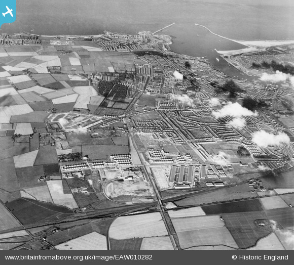
EAW010282 ENGLAND (1947). Development around Billy Mill and West Chirton, Billy Mill, from the west, 1947
    © Hawlfraint cyfranwyr OpenStreetMap a thrwyddedwyd gan yr OpenStreetMap Foundation. 2025. Trwyddedir y gartograffeg fel CC BY-SA.
  
Delweddau cyfagos (5)
Manylion
| Pennawd | [EAW010282] Development around Billy Mill and West Chirton, Billy Mill, from the west, 1947 | 
| Cyfeirnod | EAW010282 | 
| Dyddiad | 24-August-1947 | 
| Dolen | |
| Enw lle | BILLY MILL | 
| Plwyf | |
| Ardal | |
| Gwlad | ENGLAND | 
| Dwyreiniad / Gogleddiad | 433143, 568805 | 
| Hydred / Lledred | -1.4816706117557, 55.012623096258 | 
| Cyfeirnod Grid Cenedlaethol | NZ331688 | 
Pinnau
Byddwch y cyntaf i ychwanegu sylw at y ddelwedd hon!
 
             
  ![[EAW010282] Development around Billy Mill and West Chirton, Billy Mill, from the west, 1947](http://britainfromabove.org.uk/sites/all/libraries/aerofilms-images/public/100x100/EAW/010/EAW010282.jpg) 
  
                                          ![[EAW010295] Development around Billy Mill and West Chirton, Billy Mill, from the west, 1947. This image was marked by Aerofilms Ltd for photo editing.](http://britainfromabove.org.uk/sites/all/libraries/aerofilms-images/public/100x100/EAW/010/EAW010295.jpg) 
 ![[EAW010296] Development around West Chirton and Billy Mill, West Chirton, from the south, 1947. This image was marked by Aerofilms Ltd for photo editing.](http://britainfromabove.org.uk/sites/all/libraries/aerofilms-images/public/100x100/EAW/010/EAW010296.jpg) 
 ![[EAW010281] Development around Billy Mill and West Chirton, Billy Mill, from the north-west, 1947](http://britainfromabove.org.uk/sites/all/libraries/aerofilms-images/public/100x100/EAW/010/EAW010281.jpg) 
 ![[EAW010290] Development around West Chirton and Billy Mill, West Chirton, from the west, 1947. This image was marked by Aerofilms Ltd for photo editing.](http://britainfromabove.org.uk/sites/all/libraries/aerofilms-images/public/100x100/EAW/010/EAW010290.jpg)