
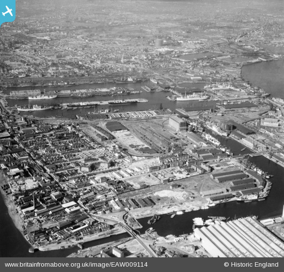
EAW009114 ENGLAND (1947). Millwall, Isle of Dogs, 1947
© Hawlfraint cyfranwyr OpenStreetMap a thrwyddedwyd gan yr OpenStreetMap Foundation. 2026. Trwyddedir y gartograffeg fel CC BY-SA.
Delweddau cyfagos (10)
EAW009114

EPW044135

EPW032138

EPW032140

EPW032141

EPW032136

EPW032139

EPW032143

EPW032137

EPW032142

Manylion
| Pennawd | [EAW009114] Millwall, Isle of Dogs, 1947 |
| Cyfeirnod | EAW009114 |
| Dyddiad | 14-August-1947 |
| Dolen | |
| Enw lle | ISLE OF DOGS |
| Plwyf | |
| Ardal | |
| Gwlad | ENGLAND |
| Dwyreiniad / Gogleddiad | 537551, 179725 |
| Hydred / Lledred | -0.01811588432718, 51.499221010091 |
| Cyfeirnod Grid Cenedlaethol | TQ376797 |
Pinnau

redmist |
Wednesday 3rd of November 2021 10:28:52 PM | |
|
Grollo |
Tuesday 1st of March 2016 05:39:12 AM | |
|
Grollo |
Tuesday 1st of March 2016 05:37:44 AM | |
|
Chelsea61 |
Wednesday 6th of November 2013 06:31:21 PM |