
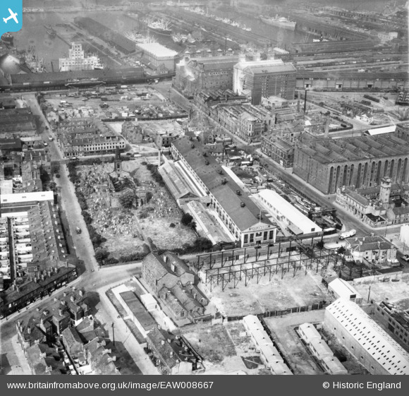
EAW008667 ENGLAND (1947). The Littlewoods Building on Irlam Road, the ruins of St Mary's Church and environs, Bootle, 1947
© Hawlfraint cyfranwyr OpenStreetMap a thrwyddedwyd gan yr OpenStreetMap Foundation. 2026. Trwyddedir y gartograffeg fel CC BY-SA.
Delweddau cyfagos (12)
EAW008667

EAW008669

EAW008687

EAW008670

EAW008668

EAW008671

EAW008681
 and environs, Bootle, 1947. This image was marked by Aerofilms Ltd for photo editing.")
EAW008672
 and environs, Bootle, 1947")
EAW008684
 and environs, Bootle, 1947. This image was marked by Aerofilms Ltd for photo editing.")
EAW008688

EAW008682
 and environs, Bootle, 1947")
EAW008683
 and environs, Bootle, 1947. This image was marked by Aerofilms Ltd for photo editing.")
Manylion
| Pennawd | [EAW008667] The Littlewoods Building on Irlam Road, the ruins of St Mary's Church and environs, Bootle, 1947 |
| Cyfeirnod | EAW008667 |
| Dyddiad | 1-August-1947 |
| Dolen | |
| Enw lle | BOOTLE |
| Plwyf | |
| Ardal | |
| Gwlad | ENGLAND |
| Dwyreiniad / Gogleddiad | 333658, 395244 |
| Hydred / Lledred | -2.9990678569769, 53.449520743591 |
| Cyfeirnod Grid Cenedlaethol | SJ337952 |
