
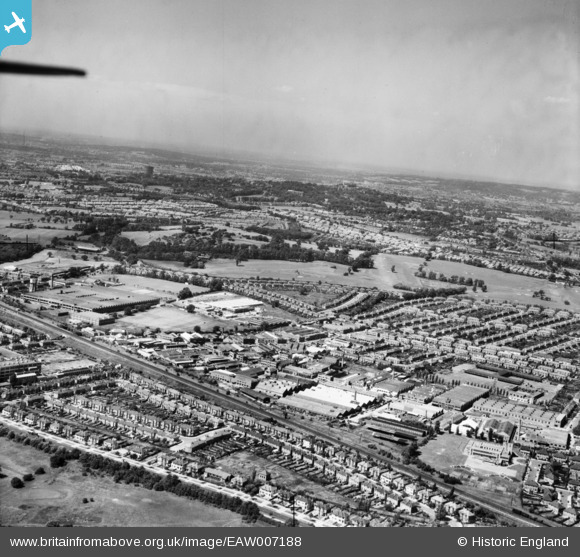
EAW007188 ENGLAND (1947). The Perivale Industrial Park and Sudbury Golf Course, Perivale, from the south-east, 1947
© Hawlfraint cyfranwyr OpenStreetMap a thrwyddedwyd gan yr OpenStreetMap Foundation. 2026. Trwyddedir y gartograffeg fel CC BY-SA.
Delweddau cyfagos (3)
EAW007188

EPW035535

EPW038723

Manylion
| Pennawd | [EAW007188] The Perivale Industrial Park and Sudbury Golf Course, Perivale, from the south-east, 1947 |
| Cyfeirnod | EAW007188 |
| Dyddiad | June-1947 |
| Dolen | |
| Enw lle | PERIVALE |
| Plwyf | |
| Ardal | |
| Gwlad | ENGLAND |
| Dwyreiniad / Gogleddiad | 517103, 183006 |
| Hydred / Lledred | -0.31149809534911, 51.533319771154 |
| Cyfeirnod Grid Cenedlaethol | TQ171830 |
Pinnau

Des Elmes |
Wednesday 6th of April 2016 03:23:44 AM | |
|
Des Elmes |
Wednesday 6th of April 2016 03:23:09 AM | |
|
Des Elmes |
Wednesday 6th of April 2016 03:22:26 AM | |

ChristopherD |
Monday 23rd of June 2014 05:09:02 AM | |
|
ChristopherD |
Monday 23rd of June 2014 05:08:20 AM | |
|
ChristopherD |
Monday 23rd of June 2014 05:05:24 AM |