
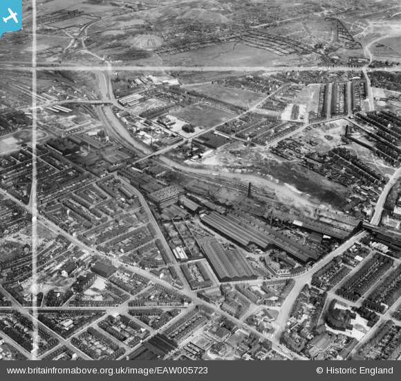
EAW005723 ENGLAND (1947). The Brown Bayleys Steel Works and the surrounding residential area, Sheffield, 1947. This image was marked by Aerofilms Ltd for photo editing.
© Hawlfraint cyfranwyr OpenStreetMap a thrwyddedwyd gan yr OpenStreetMap Foundation. 2026. Trwyddedir y gartograffeg fel CC BY-SA.
Delweddau cyfagos (14)
EAW005723

EAW005731

EAW005732

EAW006266

EAW006269

EAW005727

EAW005725

EAW005730

EAW006267

EAW005728

EAW005726

EAW005729

EAW006268

EAW005724

Manylion
| Pennawd | [EAW005723] The Brown Bayleys Steel Works and the surrounding residential area, Sheffield, 1947. This image was marked by Aerofilms Ltd for photo editing. |
| Cyfeirnod | EAW005723 |
| Dyddiad | 15-May-1947 |
| Dolen | |
| Enw lle | SHEFFIELD |
| Plwyf | |
| Ardal | |
| Gwlad | ENGLAND |
| Dwyreiniad / Gogleddiad | 438474, 389015 |
| Hydred / Lledred | -1.4213350684433, 53.396299740111 |
| Cyfeirnod Grid Cenedlaethol | SK385890 |
Pinnau

Cyberbia |
Thursday 17th of October 2019 07:22:45 PM | |

Class31 |
Tuesday 21st of July 2015 04:25:00 PM | |
|
Class31 |
Tuesday 21st of July 2015 04:23:58 PM | |
|
Class31 |
Tuesday 21st of July 2015 04:23:24 PM | |
|
Class31 |
Tuesday 21st of July 2015 04:22:00 PM |
Cyfraniadau Grŵp
We are looking north east. |
Class31 |
Tuesday 21st of July 2015 04:24:22 PM |