
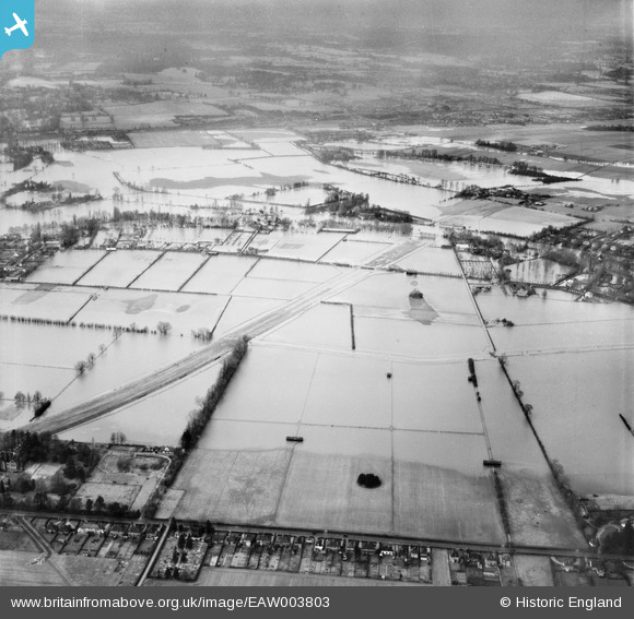
EAW003803 ENGLAND (1947). Flooding around Pigeonhill Eyot at the site of the M4 Motorway, Bray, 1947
© Hawlfraint cyfranwyr OpenStreetMap a thrwyddedwyd gan yr OpenStreetMap Foundation. 2026. Trwyddedir y gartograffeg fel CC BY-SA.
Delweddau cyfagos (7)
EAW003803

EPW052028

EPW052026

EPW052031

EAW003805

EAW003804

EPW052030

Manylion
| Pennawd | [EAW003803] Flooding around Pigeonhill Eyot at the site of the M4 Motorway, Bray, 1947 |
| Cyfeirnod | EAW003803 |
| Dyddiad | 19-March-1947 |
| Dolen | |
| Enw lle | BRAY |
| Plwyf | BRAY |
| Ardal | |
| Gwlad | ENGLAND |
| Dwyreiniad / Gogleddiad | 490843, 179120 |
| Hydred / Lledred | -0.69101985727679, 51.503221793115 |
| Cyfeirnod Grid Cenedlaethol | SU908791 |
Pinnau

Isleworth1961 |
Saturday 24th of February 2018 04:37:41 PM | |
|
dave43 |
Monday 9th of September 2013 10:17:57 PM | |
|
dave43 |
Monday 9th of September 2013 10:16:11 PM |