
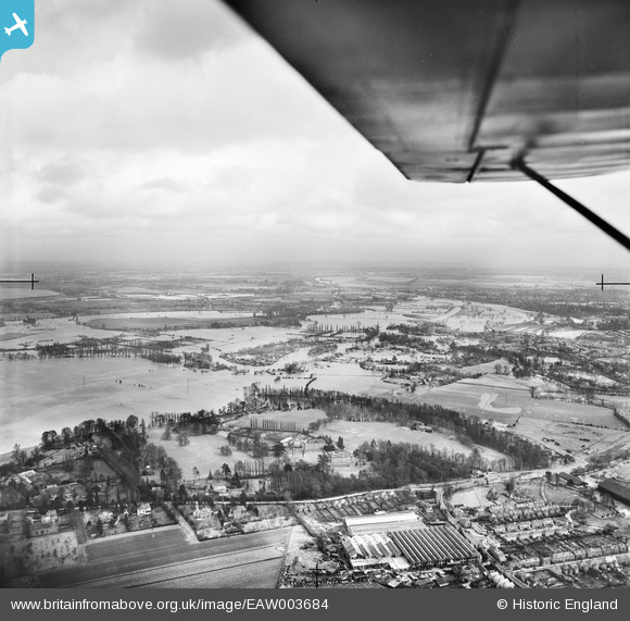
EAW003684 ENGLAND (1947). The River Thames in flood surrounding Woburn Park and the Chertsey Meads, Hamm Moor, from the south-west, 1947
© Hawlfraint cyfranwyr OpenStreetMap a thrwyddedwyd gan yr OpenStreetMap Foundation. 2026. Trwyddedir y gartograffeg fel CC BY-SA.
Delweddau cyfagos (3)
EAW003684

EPW049543

EPW049545

Manylion
| Pennawd | [EAW003684] The River Thames in flood surrounding Woburn Park and the Chertsey Meads, Hamm Moor, from the south-west, 1947 |
| Cyfeirnod | EAW003684 |
| Dyddiad | 18-March-1947 |
| Dolen | |
| Enw lle | HAMM MOOR |
| Plwyf | |
| Ardal | |
| Gwlad | ENGLAND |
| Dwyreiniad / Gogleddiad | 506021, 165386 |
| Hydred / Lledred | -0.47650761687189, 51.377117295353 |
| Cyfeirnod Grid Cenedlaethol | TQ060654 |
Pinnau

Matt Aldred edob.mattaldred.com |
Wednesday 31st of July 2024 03:57:30 PM | |
|
Matt Aldred edob.mattaldred.com |
Wednesday 31st of July 2024 03:56:41 PM | |

tima |
Friday 19th of April 2019 08:58:29 AM | |
|
mpg |
Wednesday 29th of October 2014 10:33:43 PM | |
|
mpg |
Wednesday 29th of October 2014 10:31:33 PM |