
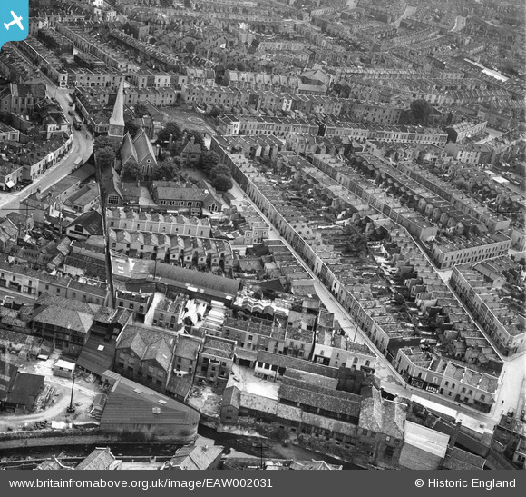
EAW002031 ENGLAND (1946). Bean Street and environs, Bristol, 1946
© Hawlfraint cyfranwyr OpenStreetMap a thrwyddedwyd gan yr OpenStreetMap Foundation. 2026. Trwyddedir y gartograffeg fel CC BY-SA.
Delweddau cyfagos (10)
EAW002031

EAW002032

EAW002029

EAW002030

EAW002028

EAW002026

EAW002023

EAW002024

EAW002027

EAW002025

Manylion
| Pennawd | [EAW002031] Bean Street and environs, Bristol, 1946 |
| Cyfeirnod | EAW002031 |
| Dyddiad | 29-July-1946 |
| Dolen | |
| Enw lle | BRISTOL |
| Plwyf | |
| Ardal | |
| Gwlad | ENGLAND |
| Dwyreiniad / Gogleddiad | 360245, 174164 |
| Hydred / Lledred | -2.572346801658, 51.46456190108 |
| Cyfeirnod Grid Cenedlaethol | ST602742 |
Pinnau

Sparky |
Monday 18th of September 2017 08:00:48 PM | |
|
Sparky |
Monday 18th of September 2017 07:59:32 PM | |
|
Sparky |
Monday 18th of September 2017 07:58:58 PM | |

MikeB |
Friday 27th of January 2017 09:09:16 AM | |
|
MikeB |
Friday 27th of January 2017 09:07:35 AM | |
|
MikeB |
Friday 27th of January 2017 09:06:12 AM | |
|
MikeB |
Friday 27th of January 2017 09:05:18 AM | |
|
MikeB |
Friday 27th of January 2017 07:56:17 AM | |
|
MikeB |
Friday 27th of January 2017 07:55:47 AM | |
|
MikeB |
Friday 27th of January 2017 07:54:46 AM |