
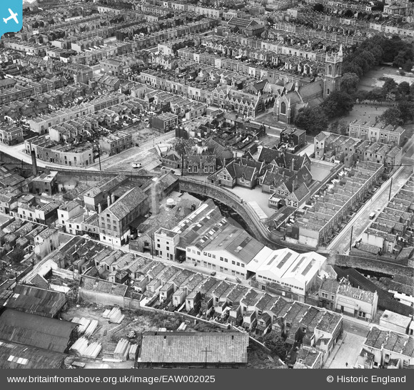
EAW002025 ENGLAND (1946). John Somers & Sons Packing Case Factory, Newfoundland Road Schools and environs, Bristol, 1946
© Hawlfraint cyfranwyr OpenStreetMap a thrwyddedwyd gan yr OpenStreetMap Foundation. 2026. Trwyddedir y gartograffeg fel CC BY-SA.
Delweddau cyfagos (10)
EAW002025

EAW002027

EAW002023

EAW002024

EAW002026

EAW002029

EAW002030

EAW002032

EAW002028

EAW002031

Manylion
| Pennawd | [EAW002025] John Somers & Sons Packing Case Factory, Newfoundland Road Schools and environs, Bristol, 1946 |
| Cyfeirnod | EAW002025 |
| Dyddiad | 29-July-1946 |
| Dolen | |
| Enw lle | BRISTOL |
| Plwyf | |
| Ardal | |
| Gwlad | ENGLAND |
| Dwyreiniad / Gogleddiad | 360050, 174045 |
| Hydred / Lledred | -2.5751405839203, 51.463478104716 |
| Cyfeirnod Grid Cenedlaethol | ST601740 |
Pinnau

Sparky |
Monday 18th of September 2017 07:52:21 PM | |
|
Sparky |
Monday 18th of September 2017 07:51:58 PM | |
|
Sparky |
Monday 18th of September 2017 07:51:31 PM | |
|
Sparky |
Sunday 6th of August 2017 09:33:33 AM | |
|
Sparky |
Sunday 6th of August 2017 09:32:28 AM | |
|
Sparky |
Sunday 6th of August 2017 09:30:57 AM | |

Class31 |
Wednesday 11th of December 2013 08:17:27 PM | |
|
Class31 |
Wednesday 11th of December 2013 08:08:11 PM | |
|
Class31 |
Wednesday 11th of December 2013 10:37:35 AM | |
|
Class31 |
Wednesday 11th of December 2013 10:37:09 AM | |
|
Class31 |
Wednesday 11th of December 2013 10:36:03 AM | |
|
Class31 |
Wednesday 11th of December 2013 10:35:20 AM | |
|
Class31 |
Wednesday 11th of December 2013 10:34:40 AM | |
|
Class31 |
Wednesday 11th of December 2013 10:32:41 AM | |
|
Class31 |
Wednesday 11th of December 2013 10:31:46 AM | |
|
Class31 |
Wednesday 11th of December 2013 10:27:22 AM | |
|
Class31 |
Monday 2nd of September 2013 02:24:34 PM |


Cyfraniadau Grŵp
I grew up on Pennywell Rd opposite to Somers until the early 1960s when the area was cleared for redevelopment and the M32. Behind the houses was another timber merchants and general woodworkers called Jennings Ltd. You can see their shed and stacks of timber at the bottom of the picture. They were located on what was the former site of Pennywell Colliery which closed down at the end of the 19th Century. I can remember the constant noise of the saw mills both front and back of us. |

Pennydreadfull |
Sunday 22nd of June 2014 03:05:09 PM |
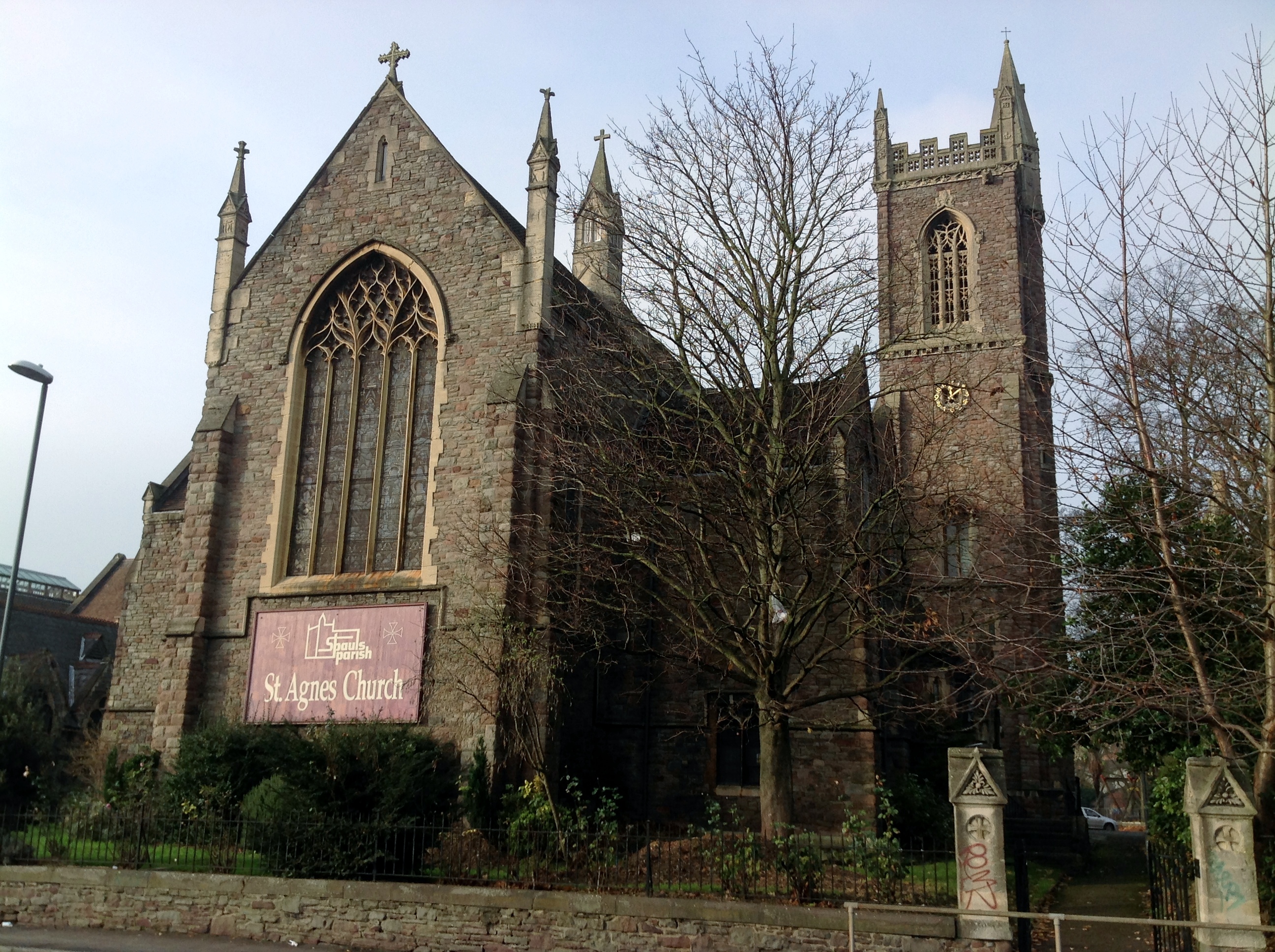
St. Agnes Church today 11/12/2013 |
Class31 |
Wednesday 11th of December 2013 07:59:42 PM |
View is looking west |
Class31 |
Wednesday 11th of December 2013 10:27:50 AM |