Skip to main content
Prydain oddi Fry
Cymraeg
|
English
Mewngofnod
|
Cofrestru
Toggle navigation
Hafan
Gwaddol
Ynghylch
Map
Orielau
Grwpiau
Cymorth
Chwilio
Pob Gwlad (96344)
Lloegr (82521)
Yr Alban (6398)
Cymru (4321)
Gweddill y Byd (3104)
Gwlad Belg (7)
Ffrainc (27)
yr Almaen (2)
Guernsey (116)
Iran (8)
Irac (6)
Iwerddon (1466)
Ynys Manaw (75)
Jersey (122)
yr Iseldiroedd (20)
Northern Ireland (1163)
Sbaen (9)
y Swisdir (26)
Featured Gallery - Images with damaged negatives
All Galleries
Pagination
First page
first
Previous page
previous
…
Tudalen
113
Tudalen
114
Tudalen
115
Tudalen
116
Current page
117
Tudalen
118
Tudalen
119
Tudalen
120
Tudalen
121
…
Next page
next
Last page
last
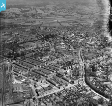
Housing surrounding Oxford Street, Ashby Road ...
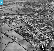
The residential area surrounding Knight Thor...
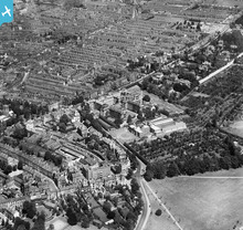
The General Hospital and the residential...
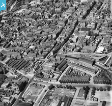
Derngate, St Giles' Street and the town centre...
The St John's Street Railway Terminus, B...
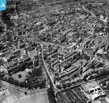
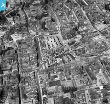
Market Square, All Saints' Church and the town ce...
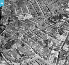
Lady's Lane, Wood Street and the town centre, Nor...
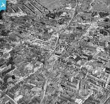
All Saints' Church, Market Square and the town ce...
Pagination
First page
first
Previous page
previous
…
Tudalen
113
Tudalen
114
Tudalen
115
Tudalen
116
Current page
117
Tudalen
118
Tudalen
119
Tudalen
120
Tudalen
121
…
Next page
next
Last page
last