
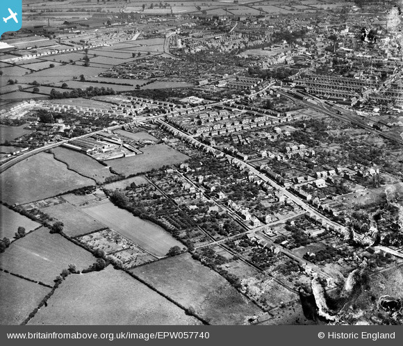
EPW057740 ENGLAND (1938). The residential area surrounding Knight Thorpe Road, Loughborough, 1938. This image has been produced from a damaged negative.
© Hawlfraint cyfranwyr OpenStreetMap a thrwyddedwyd gan yr OpenStreetMap Foundation. 2026. Trwyddedir y gartograffeg fel CC BY-SA.
Manylion
| Pennawd | [EPW057740] The residential area surrounding Knight Thorpe Road, Loughborough, 1938. This image has been produced from a damaged negative. |
| Cyfeirnod | EPW057740 |
| Dyddiad | 21-June-1938 |
| Dolen | |
| Enw lle | LOUGHBOROUGH |
| Plwyf | |
| Ardal | |
| Gwlad | ENGLAND |
| Dwyreiniad / Gogleddiad | 452416, 320363 |
| Hydred / Lledred | -1.2228575225601, 52.777969716044 |
| Cyfeirnod Grid Cenedlaethol | SK524204 |
Pinnau

Penzo |
Sunday 12th of April 2015 11:45:52 PM | |

bescotbeast |
Sunday 9th of November 2014 02:13:07 AM |