
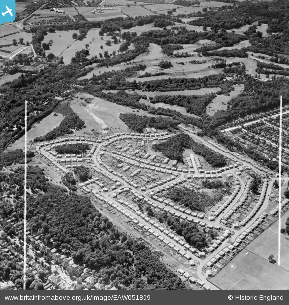
EAW051809 ENGLAND (1953). The Shrublands estate of prefabricated houses on land previously forming part of Addington Golf Course, Shirley, 1953. This image was marked by Aerofilms Ltd for photo editing.
© Copyright OpenStreetMap contributors and licensed by the OpenStreetMap Foundation. 2024. Cartography is licensed as CC BY-SA.
Nearby Images (21)
EAW051809

EAW002095

EAW004319

EAW004323

EAW002089

EAW002092

EAW002099

EAW002096

EAW004320

EAW002097

EAW002090

EAW002094

EAW002093

EAW004321

EAW002091

EAW051808

EAW004322

EAW004318

EAW002098

EAW051802

EAW051805

Details
| Title | [EAW051809] The Shrublands estate of prefabricated houses on land previously forming part of Addington Golf Course, Shirley, 1953. This image was marked by Aerofilms Ltd for photo editing. |
| Reference | EAW051809 |
| Date | 1-September-1953 |
| Link | |
| Place name | SHIRLEY |
| Parish | |
| District | |
| Country | ENGLAND |
| Easting / Northing | 537313, 164893 |
| Longitude / Latitude | -0.027294451150187, 51.365979843516 |
| National Grid Reference | TQ373649 |
Pins
 Terry the Carpet Estimator |
Thursday 30th of June 2016 03:16:42 PM |