
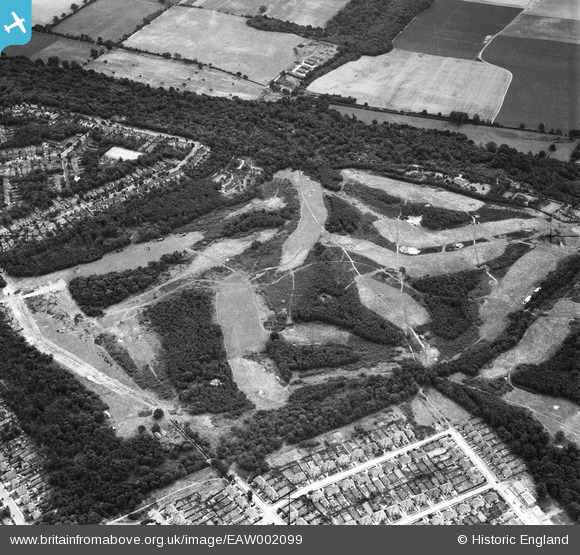
EAW002099 ENGLAND (1946). Addington Golf Course, Spring Park, 1946
© Copyright OpenStreetMap contributors and licensed by the OpenStreetMap Foundation. 2024. Cartography is licensed as CC BY-SA.
Nearby Images (25)
EAW002099

EAW004323

EAW002091

EAW002094

EAW002090

EAW002093

EAW002089

EAW004322

EAW002095

EAW002096

EAW051809

EAW002097

EAW051808

EAW004320

EAW002098

EAW004318

EAW004319

EAW051802

EAW002092

EAW051805

EAW051806

EAW004321

EAW004324

EAW051810

EAW051804

Details
| Title | [EAW002099] Addington Golf Course, Spring Park, 1946 |
| Reference | EAW002099 |
| Date | 2-August-1946 |
| Link | |
| Place name | SPRING PARK |
| Parish | |
| District | |
| Country | ENGLAND |
| Easting / Northing | 537398, 164938 |
| Longitude / Latitude | -0.026056683550635, 51.366363714779 |
| National Grid Reference | TQ374649 |
Pins
 Matt Aldred edob.mattaldred.com |
Sunday 8th of November 2020 10:29:19 PM | |
Matt Aldred edob.mattaldred.com |
Tuesday 5th of May 2020 09:11:08 PM |