
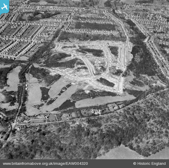
EAW004320 ENGLAND (1947). A new residential estate under construction at Spring Park, Croydon, 1947
© Copyright OpenStreetMap contributors and licensed by the OpenStreetMap Foundation. 2024. Cartography is licensed as CC BY-SA.
Nearby Images (21)
EAW004320

EAW002096

EAW002095

EAW004319

EAW051808

EAW051809

EAW004323

EAW002099

EAW002091

EAW002089

EAW002092

EAW002090

EAW002094

EAW002093

EAW051802

EAW002097

EAW004322

EAW002098

EAW004321

EAW051806

EAW004324

Details
| Title | [EAW004320] A new residential estate under construction at Spring Park, Croydon, 1947 |
| Reference | EAW004320 |
| Date | 11-April-1947 |
| Link | |
| Place name | CROYDON |
| Parish | |
| District | |
| Country | ENGLAND |
| Easting / Northing | 537384, 164812 |
| Longitude / Latitude | -0.026306385845163, 51.365234693151 |
| National Grid Reference | TQ374648 |
Pins
 Matt Aldred edob.mattaldred.com |
Tuesday 5th of May 2020 09:11:25 PM |