
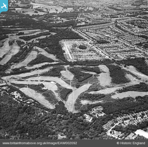
EAW002092 ENGLAND (1946). Addington Golf Course and Spring Park housing development, Spring Park, 1946
© Copyright OpenStreetMap contributors and licensed by the OpenStreetMap Foundation. 2024. Cartography is licensed as CC BY-SA.
Nearby Images (17)
EAW002092

EAW004321

EAW004319

EAW051809

EAW002095

EAW002089

EAW004323

EAW002097

EAW002099

EAW002090

EAW004320

EAW002096

EAW002094

EAW002093

EAW004318

EAW002091

EAW004322

Details
| Title | [EAW002092] Addington Golf Course and Spring Park housing development, Spring Park, 1946 |
| Reference | EAW002092 |
| Date | 2-August-1946 |
| Link | |
| Place name | SPRING PARK |
| Parish | |
| District | |
| Country | ENGLAND |
| Easting / Northing | 537224, 164908 |
| Longitude / Latitude | -0.028566464653595, 51.366136168659 |
| National Grid Reference | TQ372649 |
Pins
Be the first to add a comment to this image!