
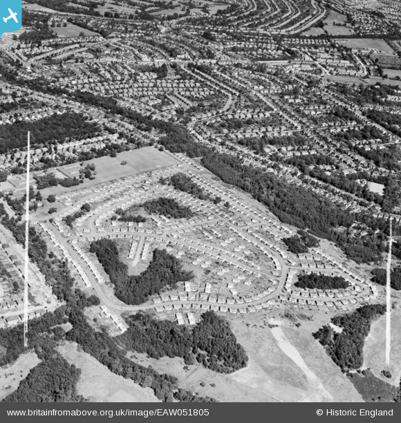
EAW051805 ENGLAND (1953). The Shrublands estate of prefabricated houses on land previously forming part of Addington Golf Course, Shirley, 1953. This image was marked by Aerofilms Ltd for photo editing.
© Copyright OpenStreetMap contributors and licensed by the OpenStreetMap Foundation. 2024. Cartography is licensed as CC BY-SA.
Nearby Images (23)
EAW051805

EAW004322

EAW004318

EAW004317

EAW002098

EAW002093

EAW002094

EAW051804

EAW002090

EAW051806

EAW002091

EAW051810

EAW004324

EAW051802

EAW002097

EAW051807

EAW002099

EAW002089

EAW004316

EAW004323

EAW051803

EAW002095

EAW051809

Details
| Title | [EAW051805] The Shrublands estate of prefabricated houses on land previously forming part of Addington Golf Course, Shirley, 1953. This image was marked by Aerofilms Ltd for photo editing. |
| Reference | EAW051805 |
| Date | 1-September-1953 |
| Link | |
| Place name | SHIRLEY |
| Parish | |
| District | |
| Country | ENGLAND |
| Easting / Northing | 537485, 165131 |
| Longitude / Latitude | -0.024732932275802, 51.368077218065 |
| National Grid Reference | TQ375651 |
Pins
Be the first to add a comment to this image!