
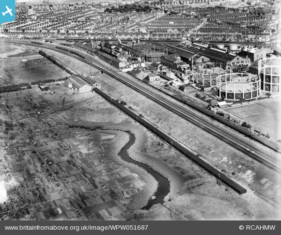
WPW051687 WALES (1936). View of Dixon's Ropeworks, Grangetown, oblique aerial view. 5"x4" black and white glass plate negative.
© Copyright OpenStreetMap contributors and licensed by the OpenStreetMap Foundation. 2026. Cartography is licensed as CC BY-SA.
Nearby Images (14)
WAW015094

WAW015095

WAW015096

WAW015097

WAW015098

WAW015099

WAW015100

WPW051681

WPW051682

WPW051683

WPW051684

WPW051685

WPW051686

WPW051687

Details
| Title | [WPW051687] View of Dixon's Ropeworks, Grangetown, oblique aerial view. 5"x4" black and white glass plate negative. |
| Reference | WPW051687 |
| Date | 1936 |
| Link | Coflein Archive Item 6370022 |
| Place name | |
| Parish | |
| District | |
| Country | WALES |
| Easting / Northing | 317315, 174459 |
| Longitude / Latitude | -3.1903664291925, 51.46256940301 |
| National Grid Reference | ST173745 |
Pins
Be the first to add a comment to this image!
User Comment Contributions
Five of these photos are not from Gabalfa. The is railway runs parallel to Penarth Road just to the left of the photograph and is in Grangetown |

AndrewF |
Monday 2nd of July 2012 09:37:56 PM |