
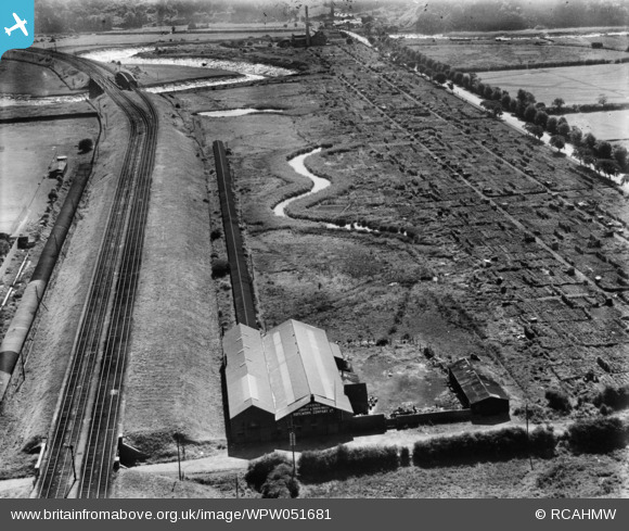
WPW051681 WALES (1936). View of Dixon's Ropeworks, Grangetown, oblique aerial view. 5"x4" black and white glass plate negative.
© Copyright OpenStreetMap contributors and licensed by the OpenStreetMap Foundation. 2026. Cartography is licensed as CC BY-SA.
Nearby Images (14)
WAW015094

WAW015095

WAW015096

WAW015097

WAW015098

WAW015099

WAW015100

WPW051681

WPW051682

WPW051683

WPW051684

WPW051685

WPW051686

WPW051687

Details
| Title | [WPW051681] View of Dixon's Ropeworks, Grangetown, oblique aerial view. 5"x4" black and white glass plate negative. |
| Reference | WPW051681 |
| Date | 1936 |
| Link | Coflein Archive Item 6370016 |
| Place name | |
| Parish | |
| District | |
| Country | WALES |
| Easting / Northing | 317315, 174459 |
| Longitude / Latitude | -3.1903664291925, 51.46256940301 |
| National Grid Reference | ST173745 |
Pins

gerry-r |
Friday 11th of July 2014 11:21:54 PM | |
|
gerry-r |
Friday 11th of July 2014 11:18:40 PM | |
|
AndrewF |
Monday 2nd of July 2012 09:39:52 PM | |
|
AndrewF |
Monday 2nd of July 2012 09:39:10 PM |
