
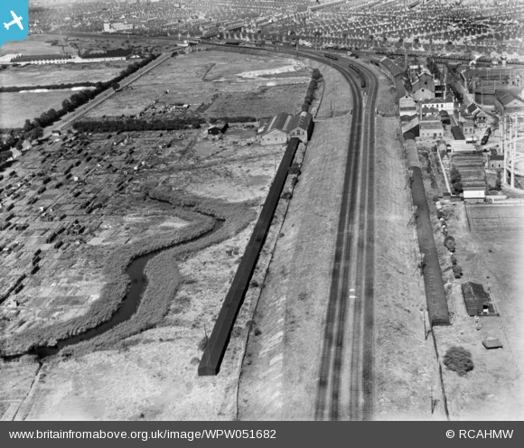
WPW051682 WALES (1936). View of Dixon's Ropeworks, Grangetown, oblique aerial view. 5"x4" black and white glass plate negative.
© Copyright OpenStreetMap contributors and licensed by the OpenStreetMap Foundation. 2026. Cartography is licensed as CC BY-SA.
Nearby Images (14)
WAW015094

WAW015095

WAW015096

WAW015097

WAW015098

WAW015099

WAW015100

WPW051681

WPW051682

WPW051683

WPW051684

WPW051685

WPW051686

WPW051687

Details
| Title | [WPW051682] View of Dixon's Ropeworks, Grangetown, oblique aerial view. 5"x4" black and white glass plate negative. |
| Reference | WPW051682 |
| Date | 1936 |
| Link | Coflein Archive Item 6370017 |
| Place name | |
| Parish | |
| District | |
| Country | WALES |
| Easting / Northing | 317315, 174459 |
| Longitude / Latitude | -3.1903664291925, 51.46256940301 |
| National Grid Reference | ST173745 |
Pins
User Comment Contributions
View looking north east. |

Class31 |
Monday 28th of July 2014 03:37:49 PM |
The Community should not be shown as Gabalfa - the photo shows Leckwith and Grangetown. |

Baramenyn |
Friday 2nd of November 2012 09:17:46 PM |
This is Grangetown, not Gabalfa. There were at least two British Rope Works in Cardiff. |
AndrewF |
Monday 2nd of July 2012 09:43:09 PM |