
WPW032694 WALES (1930). View of Ebbw Vale, showing Christ Church, oblique aerial view. 5"x4" black and white glass plate negative.

© Copyright OpenStreetMap contributors and licensed by the OpenStreetMap Foundation. 2026. Cartography is licensed as CC BY-SA.
Nearby Images (12)
WPW032438

WPW032694

WPW032695

WPW032696

WPW032705

WPW032706

WPW032707

WPW049965

WPW049967

WPW049991

WPW049993

WPW049995

Details
| Title | [WPW032694] View of Ebbw Vale, showing Christ Church, oblique aerial view. 5"x4" black and white glass plate negative. |
| Reference | WPW032694 |
| Date | 1930 |
| Link | Coflein Archive Item 6370846 |
| Place name | |
| Parish | |
| District | |
| Country | WALES |
| Easting / Northing | 316800, 210000 |
| Longitude / Latitude | -3.2062224464759, 51.782019540859 |
| National Grid Reference | SO168100 |
Pins

glyn511 |
Thursday 9th of June 2016 08:56:22 PM | |
|
glyn511 |
Thursday 9th of June 2016 08:55:30 PM | |
|
glyn511 |
Thursday 9th of June 2016 08:54:19 PM | |
|
glyn511 |
Thursday 9th of June 2016 08:54:19 PM | |
|
glyn511 |
Thursday 9th of June 2016 08:54:17 PM | |
|
glyn511 |
Friday 16th of January 2015 05:30:20 PM | |
found out now that it is not called globe street but a continuation of commercial street |
glyn511 |
Friday 21st of April 2017 05:35:04 PM |
found out now that it is not called globe street but a continuation of commercial street |
glyn511 |
Friday 21st of April 2017 05:35:05 PM |
|
david hartshorn |
Wednesday 16th of July 2014 10:34:48 AM | |
|
david hartshorn |
Wednesday 16th of July 2014 10:34:08 AM | |
|
david hartshorn |
Wednesday 16th of July 2014 10:33:03 AM | |
|
david hartshorn |
Wednesday 16th of July 2014 10:31:33 AM | |
|
david hartshorn |
Wednesday 16th of July 2014 10:30:08 AM | |
|
david hartshorn |
Wednesday 16th of July 2014 10:29:14 AM | |
|
david hartshorn |
Wednesday 16th of July 2014 10:28:03 AM | |
globe hill was at the end of commercial street, as you started down the hill there was a small group of houses on the right hand side (not victoria buildings but higher up) just by phil davies field, can anyone remember the name of this row?. grateful for any help. have been informed that this row was called globe street. have since found out that they were a continuation of commercial street |
glyn511 |
Wednesday 29th of October 2014 11:34:49 AM |
|
david hartshorn |
Wednesday 16th of July 2014 10:27:13 AM | |
|
david hartshorn |
Wednesday 16th of July 2014 10:26:12 AM | |
|
david hartshorn |
Wednesday 16th of July 2014 10:24:36 AM | |
|
david hartshorn |
Saturday 12th of July 2014 10:36:06 AM | |
zion chapel is in zion street i lived there opposite the chapel |
glyn511 |
Wednesday 29th of October 2014 11:30:18 AM |
|
david hartshorn |
Saturday 12th of July 2014 10:34:37 AM | |
|
david hartshorn |
Saturday 12th of July 2014 10:33:00 AM | |
|
david hartshorn |
Saturday 12th of July 2014 10:31:11 AM | |
|
swalian |
Saturday 24th of August 2013 12:14:22 AM | |
|
swalian |
Saturday 24th of August 2013 12:11:32 AM | |
|
swalian |
Sunday 24th of February 2013 02:43:59 AM | |
|
swalian |
Sunday 24th of February 2013 02:41:42 AM | |
|
swalian |
Sunday 13th of January 2013 02:36:46 AM | |
|
swalian |
Sunday 13th of January 2013 02:30:21 AM | |
|
swalian |
Saturday 12th of January 2013 03:13:48 AM | |
|
swalian |
Saturday 12th of January 2013 03:12:20 AM | |
|
swalian |
Saturday 12th of January 2013 03:06:00 AM | |
|
swalian |
Monday 20th of August 2012 03:35:24 AM | |
|
swalian |
Monday 20th of August 2012 03:34:25 AM | |
|
swalian |
Monday 20th of August 2012 03:32:51 AM | |
|
swalian |
Monday 20th of August 2012 03:32:20 AM | |
|
swalian |
Monday 20th of August 2012 03:31:22 AM | |
|
swalian |
Monday 20th of August 2012 03:29:50 AM | |
|
swalian |
Monday 20th of August 2012 03:26:08 AM | |
|
swalian |
Monday 20th of August 2012 03:24:59 AM | |
this is midway down victoria road where the garages are today |
glyn511 |
Friday 21st of April 2017 05:38:55 PM |
|
swalian |
Monday 20th of August 2012 03:23:33 AM | |
|
swalian |
Monday 20th of August 2012 03:20:44 AM | |
|
swalian |
Monday 20th of August 2012 03:20:08 AM | |
|
swalian |
Monday 20th of August 2012 03:19:30 AM | |
|
judgejeffriesjones |
Saturday 11th of August 2012 10:43:05 PM | |
|
geejay |
Sunday 15th of July 2012 12:17:40 AM | |
|
geejay |
Sunday 15th of July 2012 12:16:43 AM |
User Comment Contributions
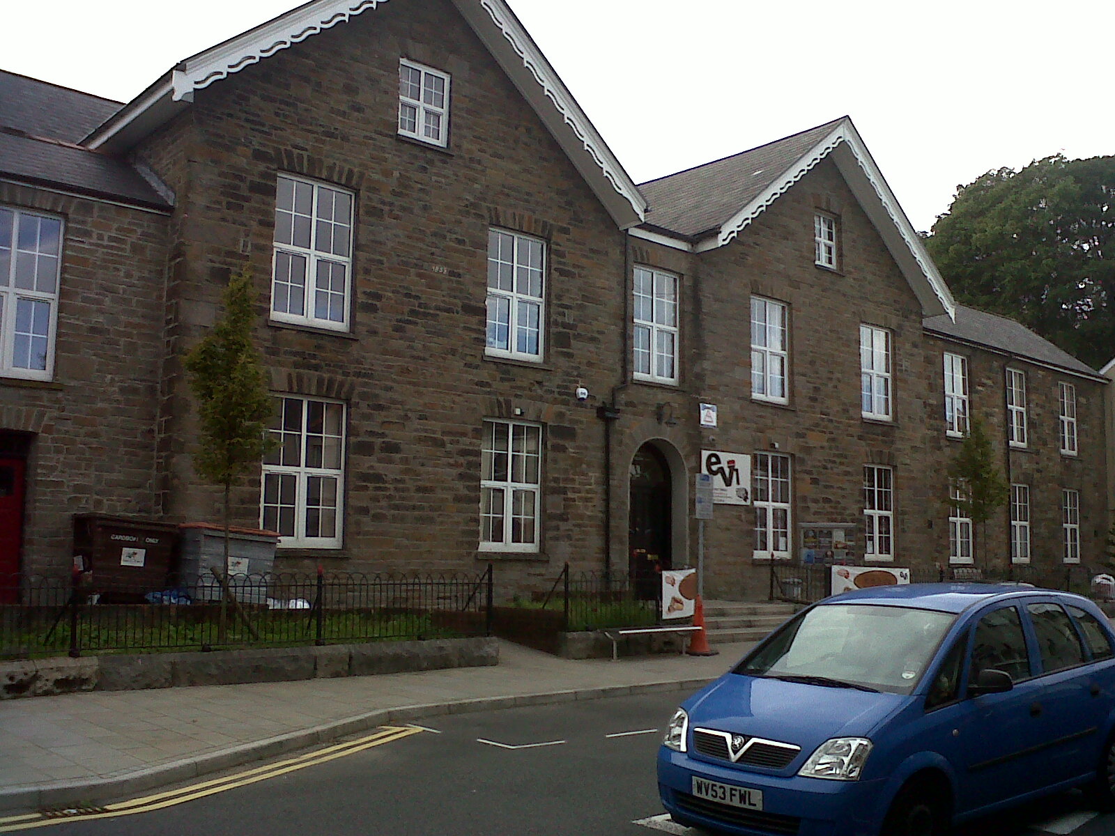
The Ebbw Vale Institute 24/08/2013 |

Class31 |
Monday 26th of August 2013 08:51:40 PM |
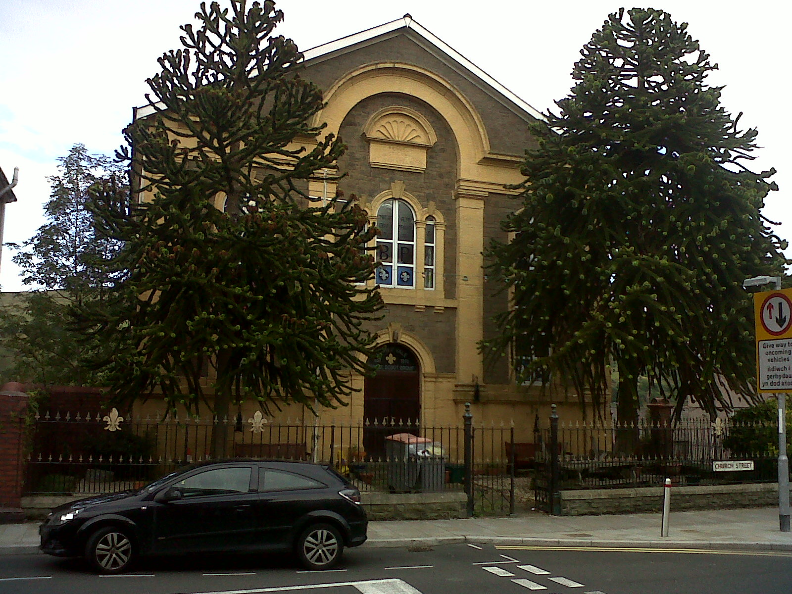
Penuel Chapel 24/08/2013 |
Class31 |
Monday 26th of August 2013 08:50:16 PM |
The rail lines are from the new works erected in 1938, Wilputte Terrace faces the lines. |
swalian |
Tuesday 26th of June 2012 03:53:37 AM |
Christchurch, the "tump" and Briery Hill School at the top. |
swalian |
Tuesday 26th of June 2012 03:33:08 AM |