
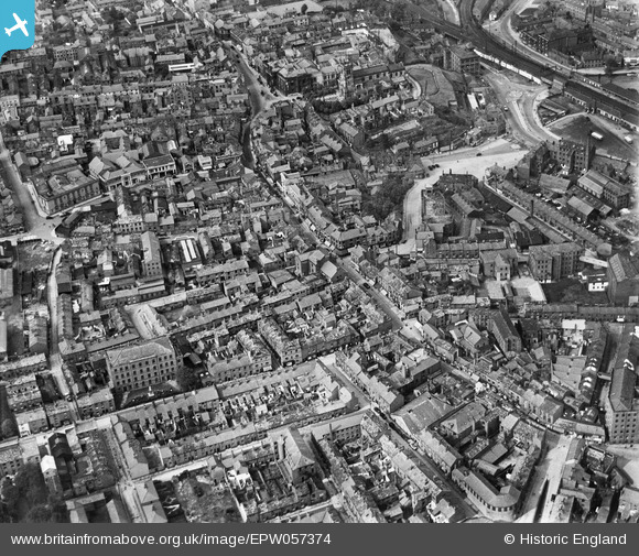
EPW057374 ENGLAND (1938). St Michael's Church, Mill Street and the town centre, Macclesfield, 1938
© Copyright OpenStreetMap contributors and licensed by the OpenStreetMap Foundation. 2026. Cartography is licensed as CC BY-SA.
Nearby Images (23)
EPW057374

EPW054374

EPW054380

EPW057639

EPW057641

EPW054378

EPW054379

EPW050709
, the Marlborough Mill and the John Clayton Ltd Timber Yard, Macclesfield, 1936. This image has been affected by flare.")
EPW054376

EPW050707
, the Marlborough Mill and the John Clayton Ltd Timber Yard, Macclesfield, 1936")
EPW050706
, the Marlborough Mill and the John Clayton Ltd Timber Yard, Macclesfield, 1936")
EPW050708
, the Marlborough Mill and the John Clayton Ltd Timber Yard, Macclesfield, 1936")
EPW016737

EPW016745

EAW018054

EAW018053

EAW018051

EAW018055

EAW018049

EPW054375

EPW057375

EAW018052

EPW016741

Details
| Title | [EPW057374] St Michael's Church, Mill Street and the town centre, Macclesfield, 1938 |
| Reference | EPW057374 |
| Date | 30-May-1938 |
| Link | |
| Place name | MACCLESFIELD |
| Parish | |
| District | |
| Country | ENGLAND |
| Easting / Northing | 391684, 373506 |
| Longitude / Latitude | -2.1246723165713, 53.25821509639 |
| National Grid Reference | SJ917735 |
Pins

jonnyhud |
Wednesday 27th of November 2013 04:44:42 PM | |
|
PW |
Wednesday 2nd of October 2013 06:11:12 PM | |
|
IvanSherratt |
Monday 26th of August 2013 06:00:23 PM |