
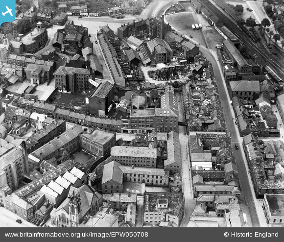
EPW050708 ENGLAND (1936). The Finishing Mill (Silk), the Marlborough Mill and the John Clayton Ltd Timber Yard, Macclesfield, 1936
© Copyright OpenStreetMap contributors and licensed by the OpenStreetMap Foundation. 2026. Cartography is licensed as CC BY-SA.
Nearby Images (23)
EPW050708
, the Marlborough Mill and the John Clayton Ltd Timber Yard, Macclesfield, 1936")
EPW050706
, the Marlborough Mill and the John Clayton Ltd Timber Yard, Macclesfield, 1936")
EPW050707
, the Marlborough Mill and the John Clayton Ltd Timber Yard, Macclesfield, 1936")
EPW050709
, the Marlborough Mill and the John Clayton Ltd Timber Yard, Macclesfield, 1936. This image has been affected by flare.")
EPW057641

EPW016745

EPW054379

EPW057635

EPW016741

EPW054376

EPW057643

EPW054374

EPW057374

EPW054380

EAW018063

EAW018061

EPW057639

EAW018057

EAW018059

EAW018060

EAW018062

EAW018058

EPW054378

Details
| Title | [EPW050708] The Finishing Mill (Silk), the Marlborough Mill and the John Clayton Ltd Timber Yard, Macclesfield, 1936 |
| Reference | EPW050708 |
| Date | June-1936 |
| Link | |
| Place name | MACCLESFIELD |
| Parish | |
| District | |
| Country | ENGLAND |
| Easting / Northing | 391857, 373413 |
| Longitude / Latitude | -2.1220763506629, 53.257381727967 |
| National Grid Reference | SJ919734 |
Pins

Tony Carter |
Thursday 13th of November 2014 06:46:05 AM | |
|
janbo |
Wednesday 4th of December 2013 05:49:09 PM | |
|
PW |
Wednesday 2nd of October 2013 06:32:01 PM | |
|
PW |
Wednesday 2nd of October 2013 06:31:40 PM | |
|
PW |
Wednesday 2nd of October 2013 06:31:04 PM | |
|
PW |
Wednesday 2nd of October 2013 06:30:16 PM |